- Reclamation
- Upper Colorado Basin
- Western Colorado Area Office
Western Colorado Area Office
The Western Colorado Area Office consists of two offices, located in Grand Junction and Durango, and several field offices with projects encompassing western Colorado, northwestern New Mexico, and northeastern Arizona. The office is responsible for Reclamation projects and program activities in the Upper Colorado, Gunnison, Yampa, White, Dolores, Uncompahgre, Animas, and San Juan river basins and works with the Ute Mountain Ute Tribe, Southern Ute Indian Tribe, Jicarilla Apache Nation, and Navajo Nation, as well as numerous water user organizations.
News and Highlights
-
News Release – July 22, 2023
 Exploratory Drilling to begin at Vallecito Dam
DURANGO, Colo. — Exploratory work will soon be conducted at Vallecito Dam, located on the Pine River 18 miles northeast of Durango, to help evaluate and guide future rehabilitation efforts to be completed under the Bureau of Reclamation's Safety of Dams Program. Read More
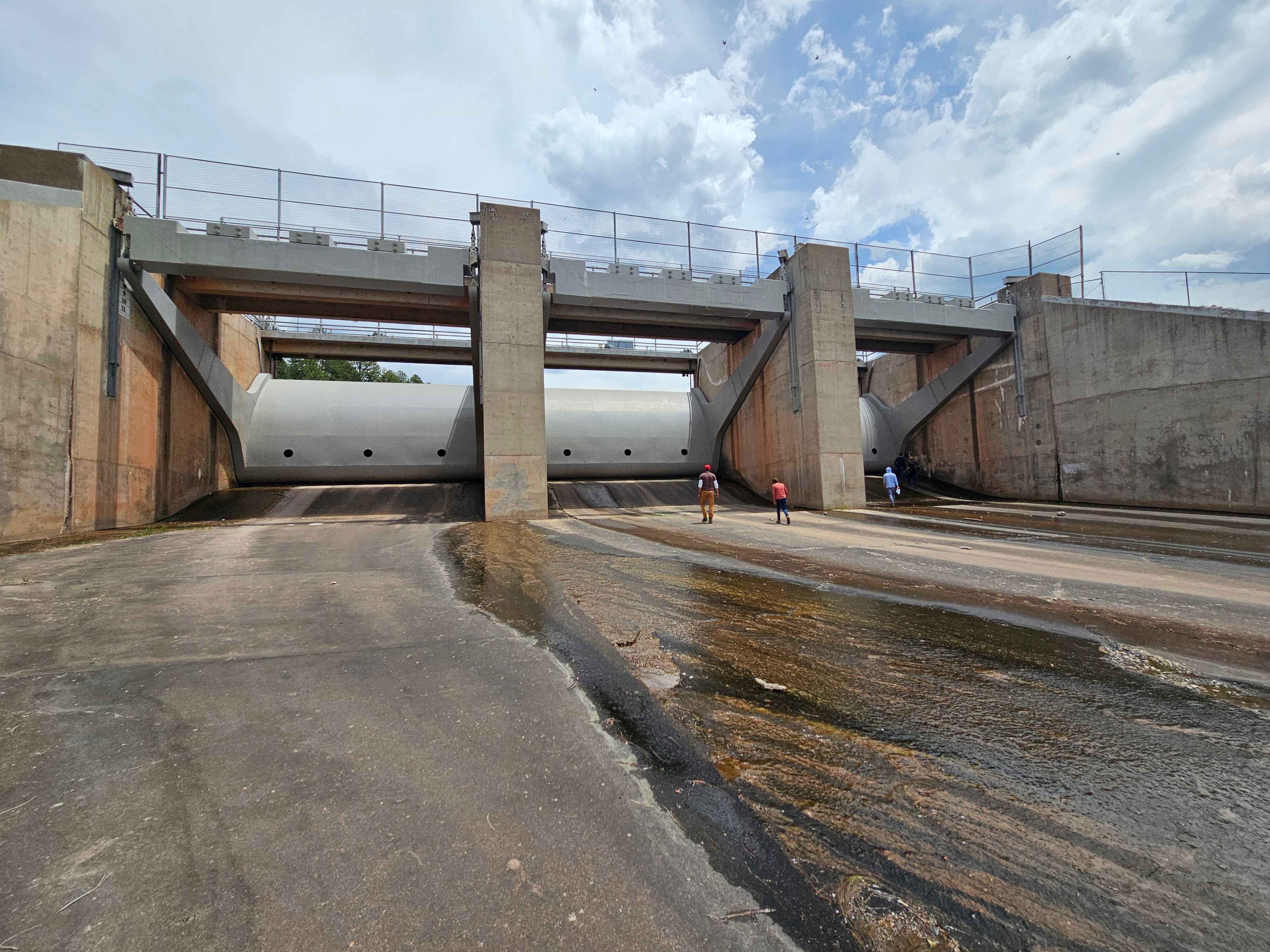
Navajo Dam Road Closure and Drilling Update
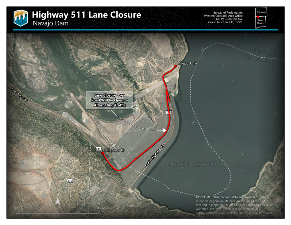
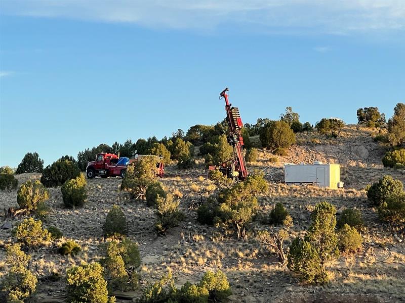
As part of Reclamation's Safety of Dams Program, crews began exploratory drilling in Jan. 2024 to gather geotechnical data on Navajo Dam, located 45 miles east of Farmington, New Mexico. Under this program, Reclamation completes annual inspections and studies in order to identify potential issues that may lead to a corrective action. While all dams have seepage, there has been an increase in the amount of seepage at Navajo Dam over the years which has led to the need for the current exploratory work.
Reclamation wants to identify the source of the seepage and evaluate if new state-of-the-art practices that were unavailable at the time of construction would reduce the seepage.
"This exploratory drilling will give Reclamation the necessary information to learn how best to address the seepage issues at Navajo Dam," said Western Colorado Area Manager, Ed Warner.
Drilling crews are currently working on Highway 539 on the top of Navajo Dam. Highway 539 is closed to public access and will remain closed until mid-May 2025. Crews will move to other areas of the dam and open highway access for summer recreation season. Roadway impacts are expected to return in Fall of 2025. More information will be shared as it becomes available.
"Drilling at Navajo Dam is time-intensive due to several factors including the sampling and testing process, complexities of drilling angled holes, onsite sample preservation, shipping preparation, and fighting external factors such as high winds, varying temperatures, and traffic control. Drilling is paused every 10-feet in holes that vary in depth from 120-feet to 450-feet to acquire samples and/or complete testing." said Reece Carpenter Resource Division Manager for the Western Colorado Area Office.
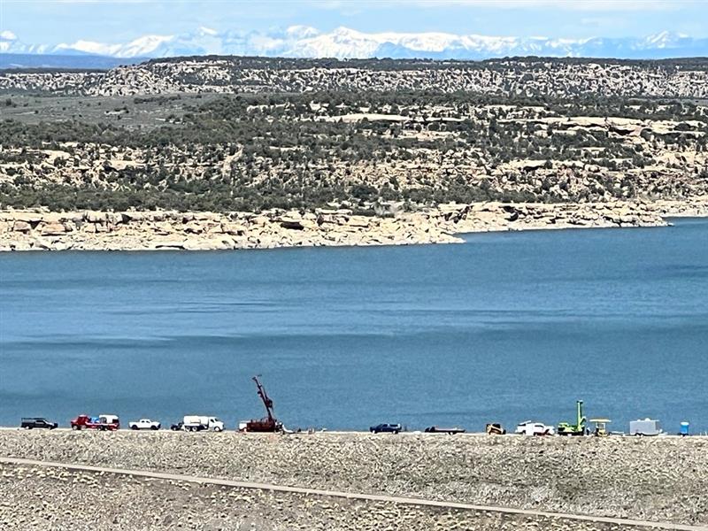
It is anticipated that drill crews will need to complete testing and data collection on 26 or more drill hole locations so that a thorough analysis can be achieved, and the seepage area identified. Due to the complexity of the exploratory drilling, it is expected that crews could be working for up to two years.
The drilling schedule and other project updates will be available on our Navajo Reservoir web page. Road closure information is also available on New Mexico's Department of Transportation website.
