- Reclamation
- California-Great Basin
- Area Offices
- KBAO
- Facilities
Facilities
-
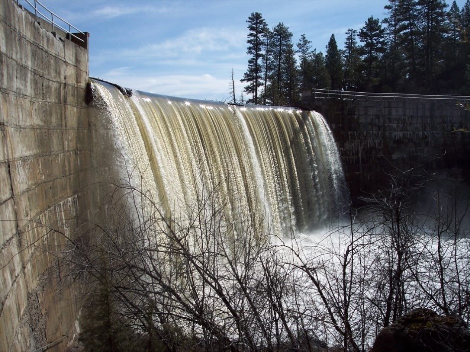
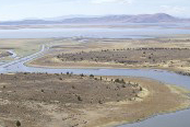
Gerber Dam And Reservoir
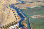
 Gerber Dam and Reservoir, on Miller Creek 14 miles east of Bonanza, Oregon, provides storage for irrigation and reduces flow into the reclaimed portions of Tule Lake and the restricted Tule Lake Sumps in the Tulelake National Wildlife Refuge. The dam, a concrete arch structure, has a height of 84.5 feet and a crest length of 460 feet. Reservoir capacity is 94,300 acre-feet.
 -
Clear Lake Dam And Reservoir
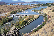
 Clear Lake Dam and Reservoir on the Lost River in California, about 19 miles southeast of Malin, Oregon, provide storage for irrigation and reduce flow into the reclaimed portion of Tule Lake and the restricted Tule Lake Sumps in Tulelake National Wildlife Refuge. The dam is a roller compacted concrete structure with a height of 42 feet and a crest length of 840 feet. The reservoir has a capacity of 527,000 acre-feet.
 -
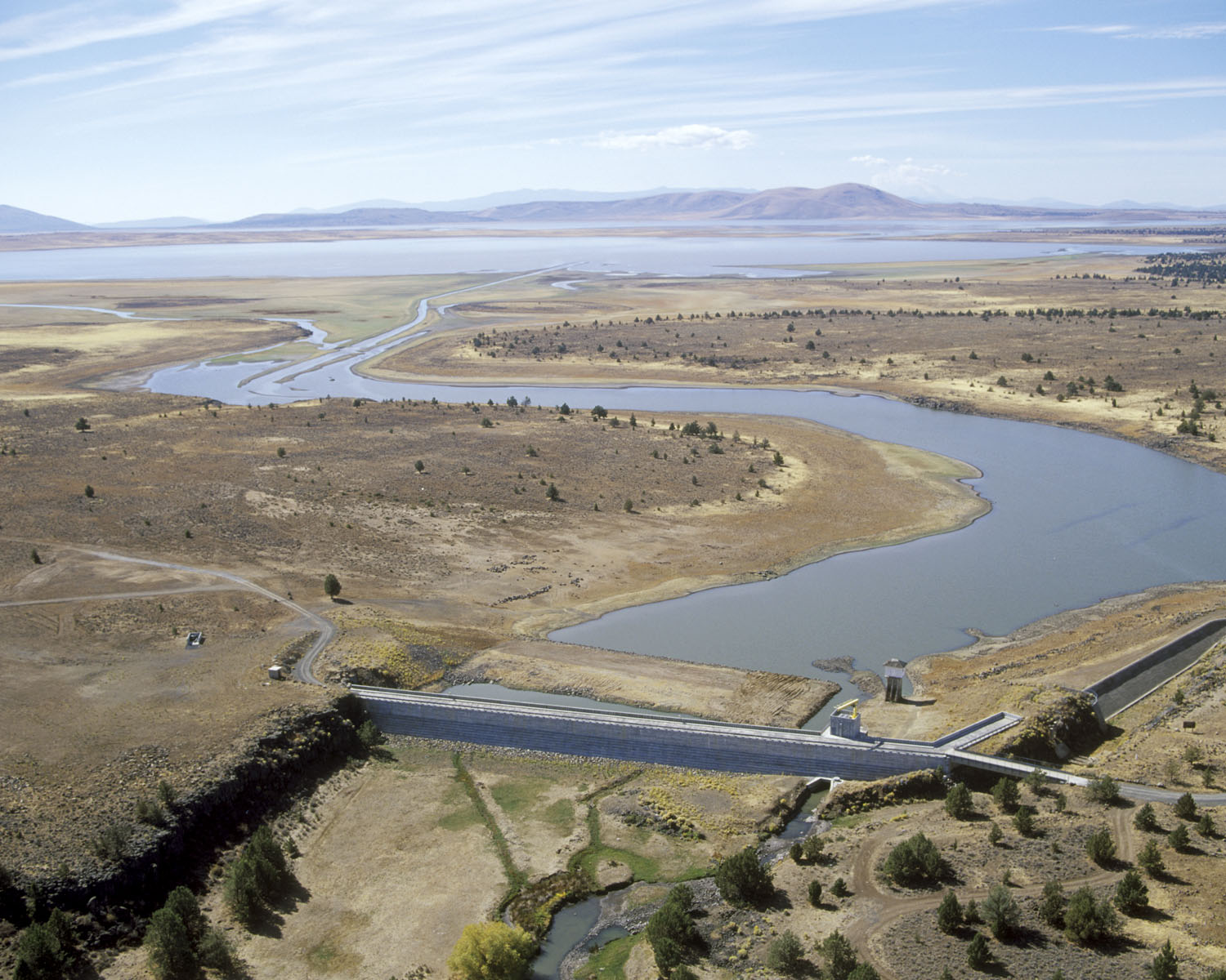
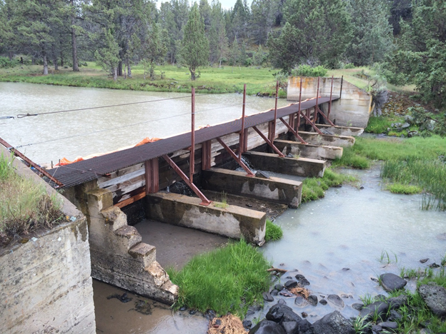
Anderson-Rose Diversion Dam
 Anderson-Rose Diversion Dam (formerly Lower Lost River Diversion Dam), on the Lost River about 3 miles southeast of Merrill, Oregon, diverts water to serve the lands reclaimed from the bed of Tule Lake. The dam is a reinforced concrete slab and buttress structure with a height of 23 feet and a crest length of 324 feet.
 -
Lost River Diversion Dam
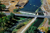
 Lost River Diversion Dam (also known as Wilson Dam or Horseshoe Dam) is on Lost River about 4 miles below Olene, Oregon. The dam diverts excess water to the Klamath River through the Lost River Diversion Channel and restrains downstream flow in Lost River to control or restrict flooding of the reclaimed portions of the Tule Lake lakebed and to regulate the flow into the restricted sumps of the Tulelake National Wildlife Refuge. It is a horseshoe shaped multiple-arch concrete structure with earth embankment wings. The structural height is 42 feet and crest length is 675 feet.
 -
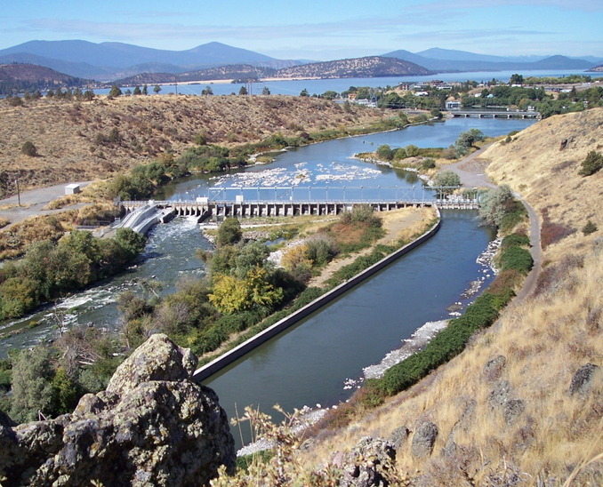
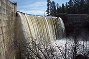
Link River Dam
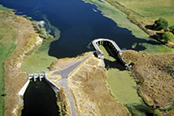
 Link River Dam west of Klamath Falls, Oregon, regulates elevations within Upper Klamath Lake and flow from the reservoir into the Klamath River. This reservoir is the principal source of water for the project. The dam is a reinforced concrete slab structure with a height of 22 feet and a crest length of 435 feet. The reservoir has an active storage capacity of 562,000 acre-feet and is operated by PacifiCorp, subject to Klamath Project rights.
 -
Malone Diversion Dam
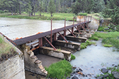
 Malone Diversion Dam, on the Lost River about 11 miles downstream from Clear Lake Dam, diverts water to serve lands in Langell Valley. This dam is an earth embankment with a concrete gate structure. It has a height of 32 feet and a crest length of 515 feet.
 -
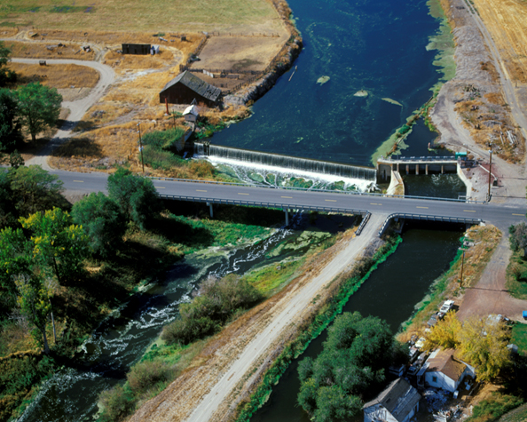
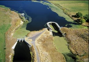
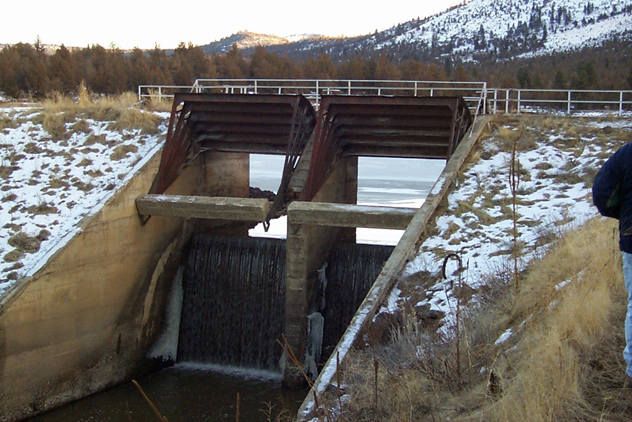
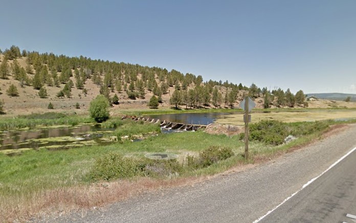
Miller Creek Diverson Dam
 Miller Diversion Dam, on Miller Creek 8 miles below Gerber Dam, diverts water to serve lands in Langell Valley. The dam is a concrete weir, removable crest, and earth embankment wing structure with a height of 10 feet and a crest length of 290 feet.
 -
Pumping Plants, Canals, Laterals, and Drains
Reclamation owns approximately 80 pumping facilities and operates these in collaboration with local districts through transferred works agreements to operate and maintain the facilities. Additional pumping projects within the basin are owned and operated by U.S. Fish and Wildlife Service, Klamath Irrigation District, Van Brimmer Ditch Company, Tulelake Irrigation District, and Horsefly Irrigation District. There are 18 pumping plants with capacities from 50 to 388 cubic feet per second, and approximately 40 pumping plants of less than 50 cubic feet per second. There are 19 canals that total 185 miles and have diversion capacities ranging from 35 to 1,150 cubic feet per second. Laterals total 490 miles and drains 545 miles.
-
Klamath Straits Drain
 The drains capacity was increased from 300 to 600 cubic feet per second in 1981. The drain conveys drainage water from Lower Klamath National Wildlife Refuge and from irrigated land which has been reclaimed from Lower Klamath Lake. The drain extends from the State Line Road approximately 20 miles north-westerly to the Klamath River. The drain removes excess winter flows and the drainage from the lower closed basin to the Klamath River. drains capacity was increased from 300 to 600 cubic feet per second in 1981. The drain conveys drainage water from Lower Klamath National Wildlife Refuge and from irrigated land which has been reclaimed from Lower Klamath Lake. The drain extends from the State Line Road approximately 20 miles north-westerly to the Klamath River. The drain removes excess winter flows and the drainage from the lower closed basin to the Klamath River.
 -
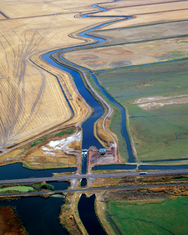
D Pumping Plant and Tule Lake Tunnel
 D Pumping Plant (D Plant) is a transferred works project operated and maintained by the Tulelake Irrigation District. D Plant pumps drain water collected in Tule Lake Sumps from TID/Lower Klamath Lake and through the Tule Lake Tunnel. Tule Lake Tunnel is a concrete-lined structure 6,600 feet in length with a capacity of 325 cubic feet per second and conveys drainage water from Tule Lake Sumps on the Tule Lake National Wildlife Refuge to the Lower Klamath National Wildlife Refuge.
 -
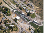
A Canal Tunnel
 This 3,300-foot tunnel, a part of the A Canal, has a capacity of 1,150 cubic feet per second and conveys irrigation water from Upper Klamath Lake to serve approximately 63,000 acres.
 -
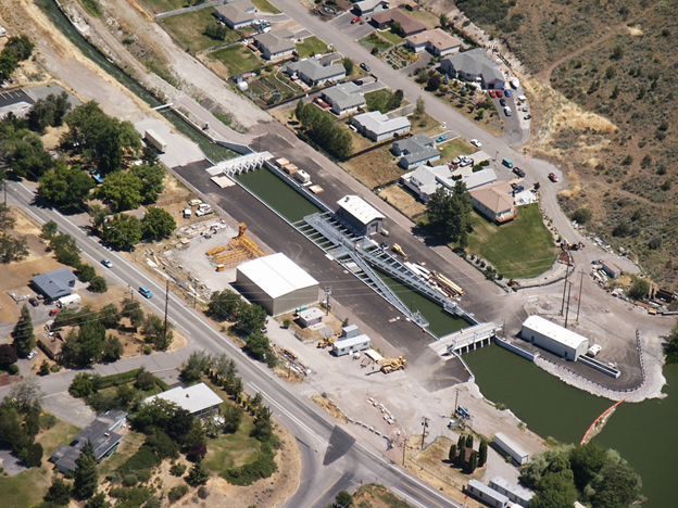
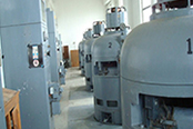
A Canal Fish Screen
 This $11.5 million project included the design and construction of a cofferdam that isolated the work area from Upper Klamath Lake, design and construction of a temporary dewatering system, demolition of the existing headgate structure and excavation of 50,000 cubic yards of material to make room for the new structures. It also included placement of 6,000 cubic yards of structural concrete in three months, the installation, startup, and testing of trash racks and a trash rake. This project includes: bulkheads and embedded steel and grating for “V” screens, primary and secondary fish screen panels and baffles, primary and secondary screen cleaners, and large electrically actuated gates, including a custom ramp gate.
 -
C-Drop Powerplant
 Completed in 2012, the C-Drop hydroelectric facility uses the force of water dropping 22 feet from the A Canal to the C Canal to generate up to 1.1 megawatts of power per year. The facility does not change diversions or timing of irrigation flows and doesn’t impact fish or wildlife.
 -
Additional Features
 There are other features impacting Klamath Project operations not owned or operated by Reclamation. Harpold Dam is a privately-owned dam operated by Horsefly Irrigation District. The dam was constructed for the purpose of maintaining hydraulic head in the Lost River near the town of Bonanza, Oregon to allow upstream irrigators to pump water from Lost River. Other features operated by Pacific