- Reclamation
- WaterSMART
- Basin Study Program
- Basin Studies
- American River Basin Study Virtual Press Kit
American River Basin Study Virtual Press Kit
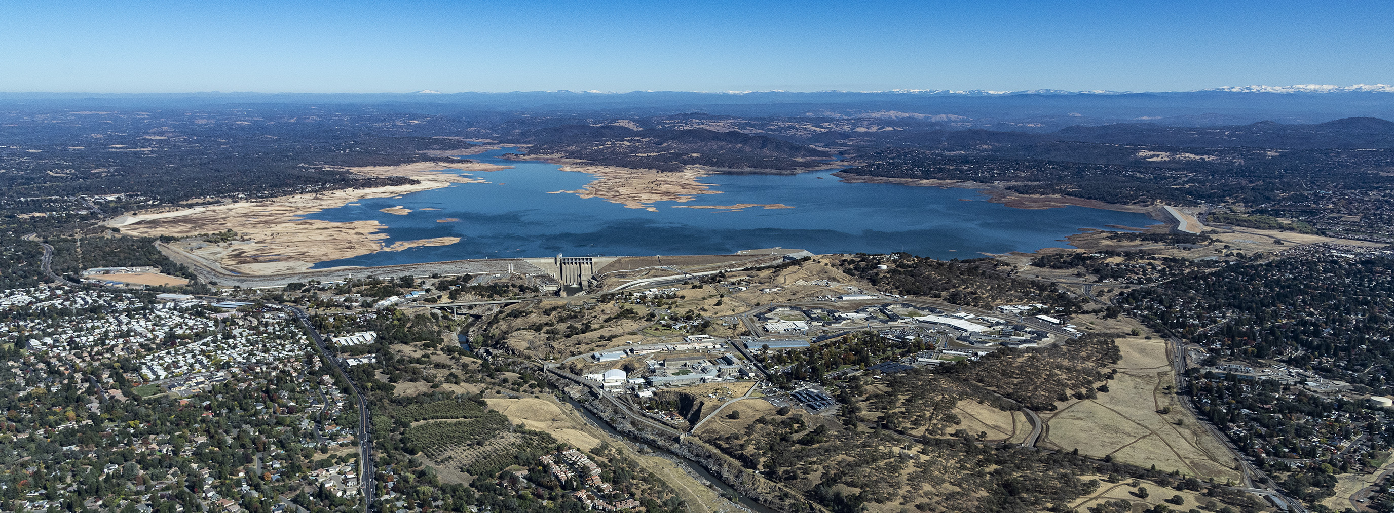
This aerial view shows low water conditions on Folsom Dam and Lake. On this date, the storage was 309,573 reservoir acre-feet, which is 32 percent of the lake's total capacity. Photo taken October 28, 2021. Andrew Innerarity/California Department of Water Resources
The American River Basin Study was selected in 2017 following the completion of the Sacramento and San Joaquin Rivers Basin Study in 2016. Water managers in the American River Basin are experiencing a growing imbalance between water demands and supplies due to climate change impacts, economic development and regulatory updates.
The American River Basin and the area covered in this study consists of 3,600 square miles in central California from the Valley through the foothills to the top of the Sierra Nevada and includes the City of Sacramento. Key Reclamation facilities in the basin include Folsom Dam and Reservoir, Nimbus Dam and Folsom South Canal. Municipal users in the basin use 516,000 acre-feet annually while agricultural users use 719,000 acre-feet annually. Water is also used for hydropower generation, recreation, and fish and wildlife.
The basin study developed data, tools, analyses and climate change adaptation strategies for the American River Basin. Strategies were examined to integrate and better coordinate local and federal water management practices to improve regional water supply reliability while enhancing Reclamation's flexibility in operating Folsom Reservoir to meet flow and water quality standards in the Sacramento-San Joaquin Delta and protect endangered fishery species in the Lower American River.
For more information, please email publicaffairs@usbr.gov.
Press Release
American River Basin Study finds that increasing temperatures and changing precipitation will impact basin through rest of 21st century (Link live at 10:30 a.m. PDT)
Press Conference
Report
American River Basin Study Report
- Appendix A - Communication and Outreach Activities
- Appendix B - Development of Future Climate and Hydrology Scenarios
- Appendix C - CalSim 3 Upper American River Module Documentation
- Appendix D - Development of Urban and Agricultural Demands
- Appendix E - Adaptation Measure Preliminary Screening Results
- Appendix F - Draft Description of Adaptaion Portfolios
- Appendix G - Adaptation Portfolios Evaluation Results
- Appendix H - Lower American River Water Temperature Modeling Documentation and Results
Images and Graphics
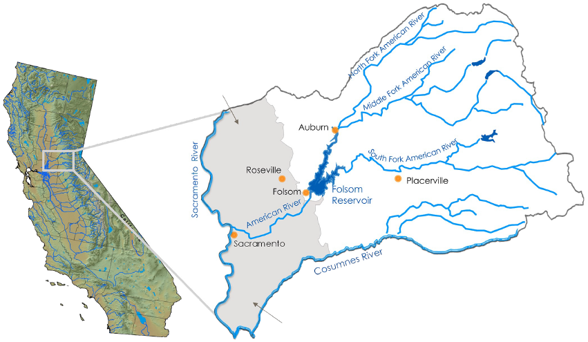
A map of the American River Basin.
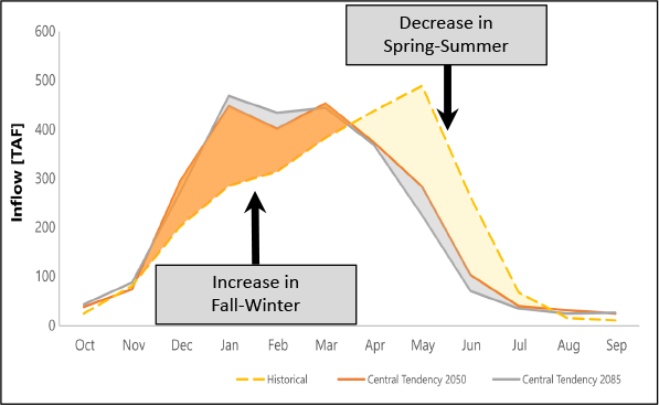
Projected impacts to runoff.
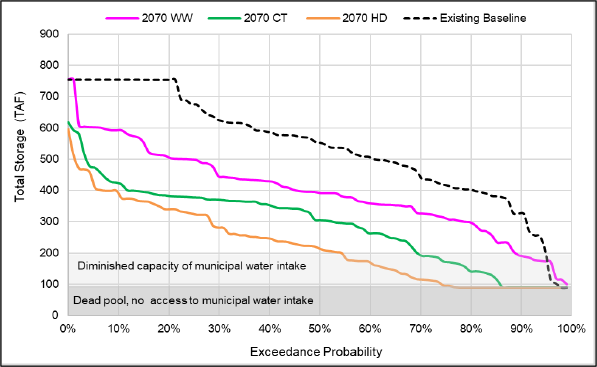
Projected impacts to reservoir storage.
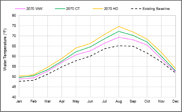
Projected impacts to water temperatures in the Lower American River Basin
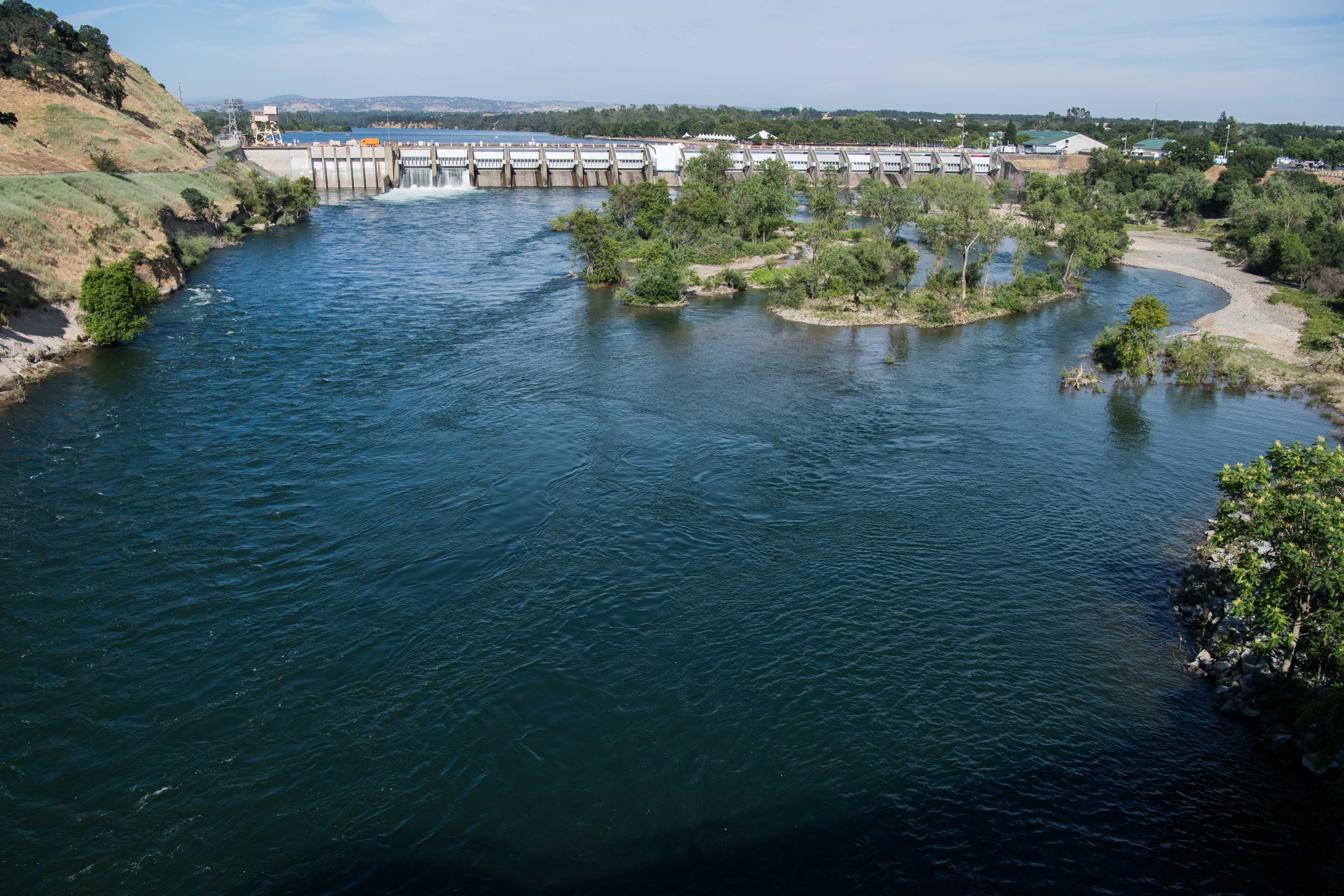
Nimbus Dam on the American River near Sacramento, California.
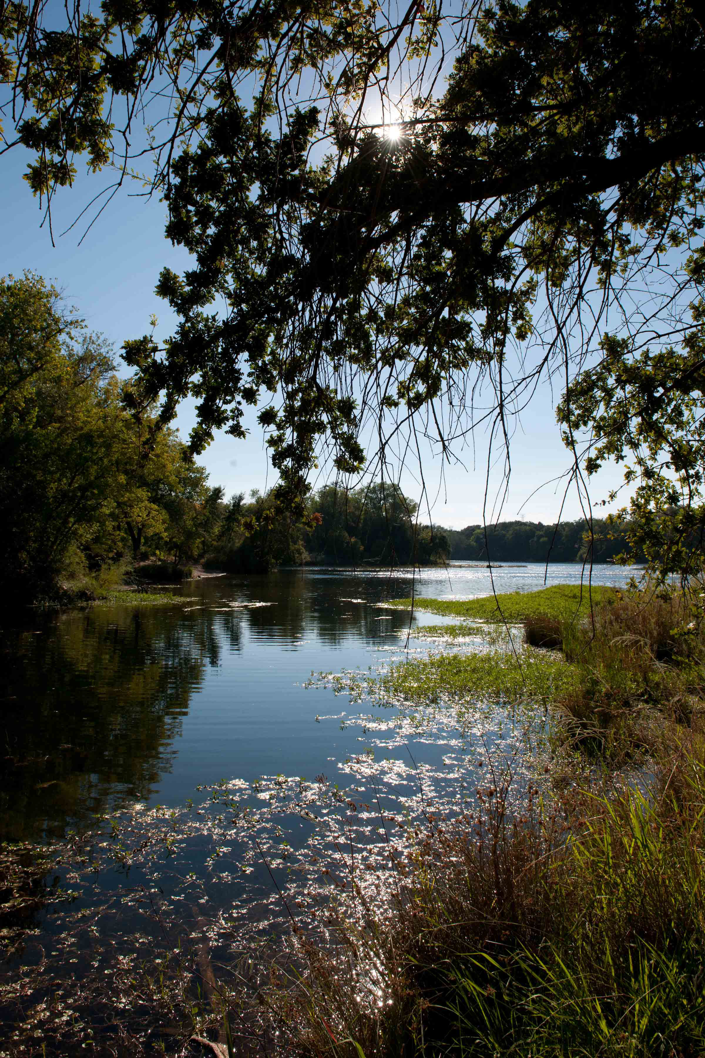
The Lower American River.
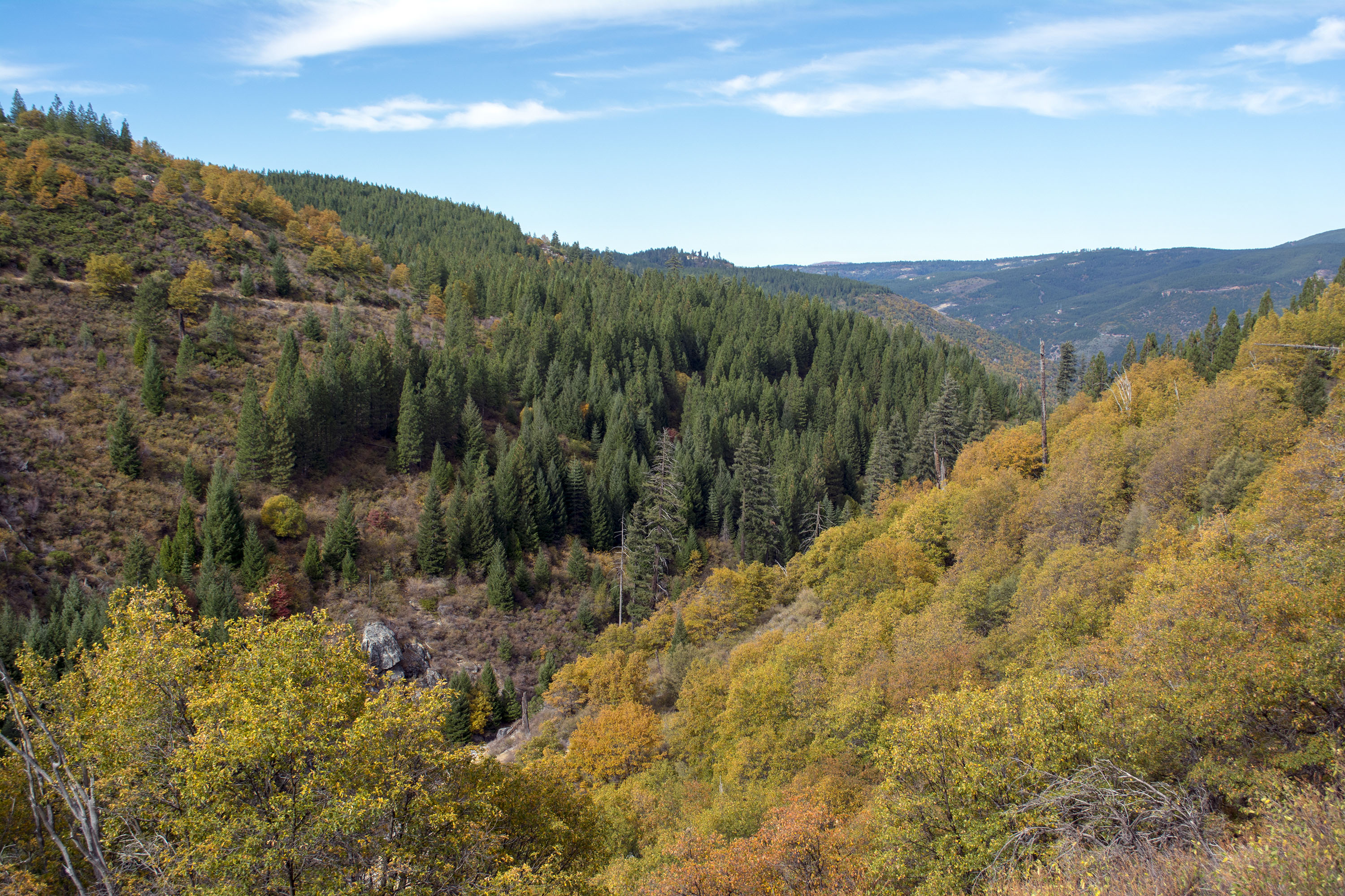
The American River Basin watershed.
