

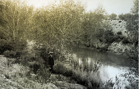
 A prehistoric Hohokam canal has been incorporated into the Consolidated Canal in the eastern Salt River Valley, 1906. (Reclamation photograph)
The Sonoran Desert is one of the hottest and driest places in the world. Ironically, it is also very "green" with a large variety of desert-adapted plants, many of which provide edible pods, flowers, seeds, roots, and tubers. Prehistoric farmers and artisans known as Hohokam survived for over 1000 years in this harsh environment because of the hundreds of miles of irrigation canals and ditches they engineered, dug, and maintained. Hohokam villages and farms were usually located along the main rivers like the Salt, Gila, and Santa Cruz, and their tributary rivers. The earliest canals found in North America are located along the Santa Cruz River in Tucson and date to around 1100 B.C. In fact, archaeological evidence indicates that irrigation developed independently in the Tucson area and was not imported from Mesoamerica. Hohokam irrigation systems reached their peak between A.D. 700 and 1400. While the technology was simple, the systems were engineering marvels, monumental in scale.
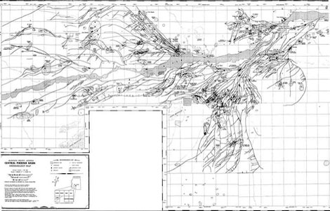 The distribution of prehistoric Hohokam irrigation canals in the Salt River Valley 1992. (Map compiled and produced by GEO-MAP, Inc. for Arizona Department of Transportation)
The lower Salt River contains the largest concentration of Hohokam canal systems; similar systems are found on the Gila and Santa Cruz rivers. The canal systems appear to have served both practical (building and maintenance) and political (administration and distribution of water) purposes. One example is Pueblo Grande in Phoenix. This primary Hohokam village was located near the head of a main canal. Smaller villages were located along the main canal and its numerous distribution ditches. The villages assisted in maintaining the canals and ditches.
Around A.D. 1300, the canal systems and the culture it supported began to collapse. What happened remains somewhat of a mystery, but extended drought, overpopulation, too much salt in the fields from hundreds of years of irrigating, major floods that destroyed key components of the irrigation system, and perhaps conflict within Hohokam society likely contributed to abandonment of Salt and Gila river valleys by A.D. 1450. Descendants of the Hohokam, today's Akimel and Tohono O'odham (Pima and Papago, respectively) practice some irrigation agriculture, but nothing like their ancestors.
The remains of Hohokam irrigation systems on the Salt River caught the attention of American settlers in the late 1860s and led to development of a second irrigation-based agricultural economy in the Salt River Valley.
Adapted and modified from Prehistoric Water Utilization and Technology in Arizona by Michael S. Foster, SWCA Environmental Consultants. Arizona State Parks, Phoenix: no date.