Geographic Information Systems
 Bureau of Reclamation, Interior Region 8: Lower Colorado Basin Geographic Information Systems professionals develop and provide geospatial information, applications, analyses, digital and analog maps to manage Reclamation's resources. The GIS personnel are located within various USBR groups within the region and area offices.
Please see the following links for program information, contacts, and data:
USBR Region 8 Offices and GIS data and projects supported:
Boulder Canyon Operations Office(BCOO) Boulder City, NV: BCOO GIS supports the hydro management efforts in the Lower Colorado Region. This includes operations of the water and power delivery, water use accounting, water delivery contracts, and support to the regional water conservation program.Lower Colorado Dams Area Office (LCDO) Hoover Dam, NV:
Hoover Dam GIS supports management, operations, and maintenance of Hoover, Davis and Parker Dams and their associated powerplants and facilities Multi-Species Conservation Program (MSCP) Boulder City, NV:The MSCP is focused on conservation of native species and their habitats, GIS specialists work with all facets of this program. For specific information please follow the link:https://www.lcrmscp.gov/Phoenix Area Office (PXAO) Phoenix, AZ: The Phoenix Area Office, Administrative Division, GIS Branch provides geospatial data management, and cartography support for environmental, engineering, and planning projects within the Phoenix Area office. The Phoenix GIS Branch also supports the LCB Region with technical GIS support and actively participating in Reclamation-wide enterprise and Open data initiatives.
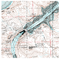
Resource Management Office (RMO) Boulder City, NV:RMO GIS creates and maintains spatial products for several offices and programs within the group. This support includes, cartographic Region 8 maps, USBR lands data, historic river imagery, historic LiDAR/bathymetry, and support to cultural and natural resources, NEPA, Salton Sea, HAZMAT, and the water quality program.
Yuma Area Office (YAO) Yuma, AZ:
YAO is responsible for scheduling Colorado River water deliveries in Arizona, California, and Mexico. YAO GIS supports the area office in the management of the Colorado river from Davis Dam to the border with Mexico, large-scale well fields near Yuma, and numerous other projects.For further inquires about Region 8 GIS data or assistance please send an email to:bor-sha-GISMaps@usbr.gov
For official FOIA requests please refer to this website: https://www.usbr.gov/foia/
