Phoenix Area Office - Facilities
Salt River Project
In much of the American West, 19th century settlers encountered scarce water supplies. With little rainfall available, they tended to farm near rivers for easy access to the valuable resource of water. Along the Salt River in the Arizona Territory they followed in the footsteps of ancient native farmers and built irrigation systems to deliver river water to their crops.
However, they could not control the rivers. Times of drought, when the rivers ran low, were countered by times of flood which could wipe out farms and communities. Throughout the west flood control, water storage and large-scale irrigation projects were attempted by various groups and organizations only to be abandoned due to lack of funding or expertise.
President Theodore Roosevelt realized that harnessing water was the key to supporting Western growth and development. The federal government had the resources to provide both funding and expertise for water projects the west desperately needed and wanted. Congress agreed and passed the Reclamation Act of 1902, creating the U.S. Reclamation Service, later named the Bureau of Reclamation.
One of the first federal projects authorized under the Reclamation Act, the Salt River Project (SRP) improved existing dams and irrigation canals and built new dams. Reliable water and power flowed into the Phoenix area. Reclamation's eventual construction of the final feature of the SRP, Bartlett Dam in 1940, marked control of the Salt and Verde Rivers . Between 1902 and 1940, the Phoenix area population increased by 60,000 people, primarily because water and power had become readily available.
The major features of the Salt River Project:
Salt River Project / Salt River Water Users Association - operating and maintaining entity
Bartlett Dam
Stewart Mountain Dam
Horse Mesa Dam
Mormon Flat Dam
Granite Reef Diversion Dam
Recreation on SRP Lakes
Webmaster:
Joseph J. Billerbeck - jbillerbeck@usbr.gov
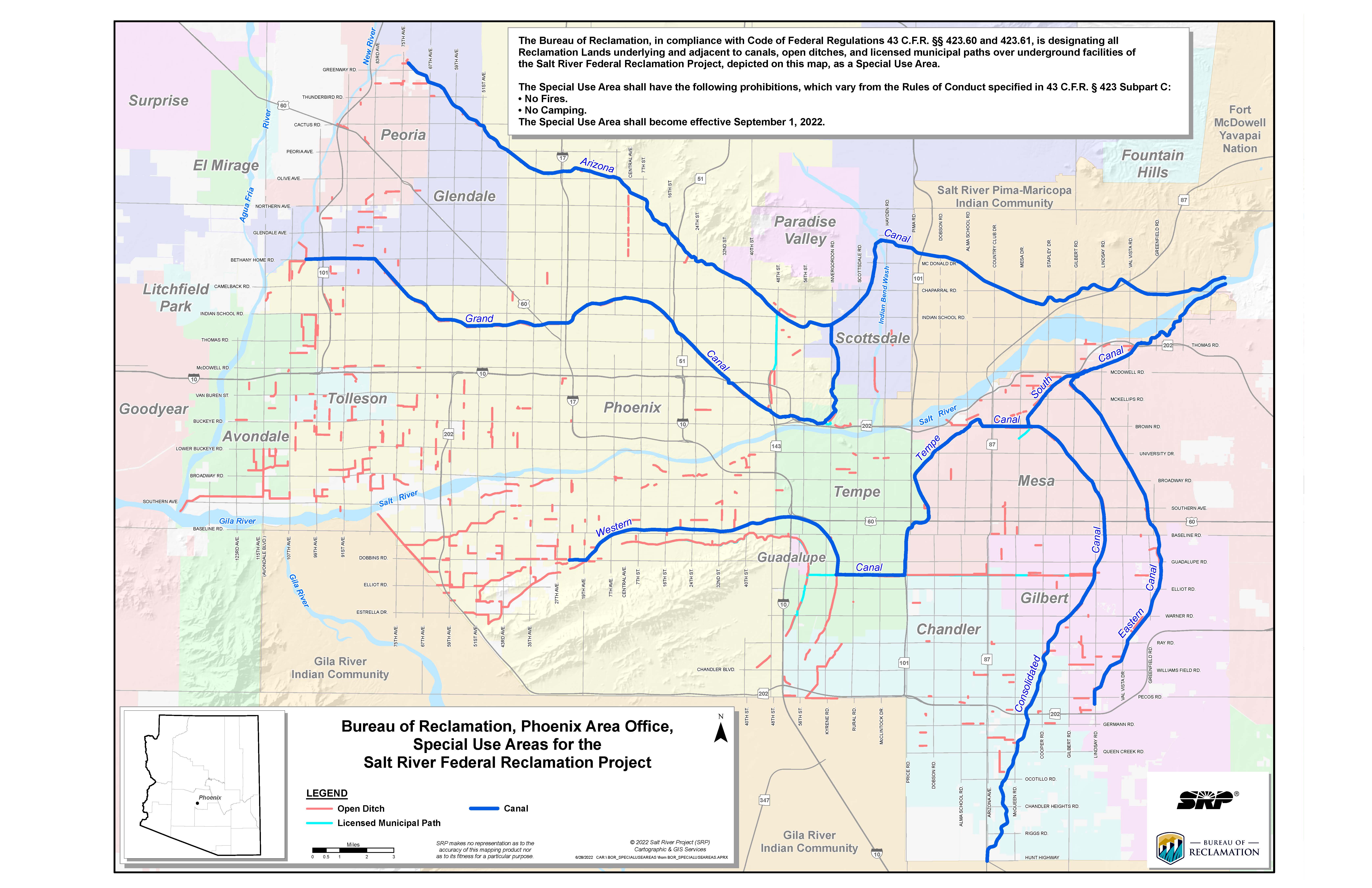
Special Use Area
In September 2022, all Bureau of Reclamation lands underlying and adjacent to canals, open ditches, and licensed municipal paths over underground facilities of the Salt River Federal Reclamation Project became a Special Use Area in accordance with 43 C.F.R. Part 423, Subpart E. The Special Use Area has the following additional prohibitions, which vary from the standard Rules of Conduct specified in 43 C.F.R. Part 423, Subpart C:
A map of the Reclamation lands included within the Special Use Area appears below.