- Reclamation
- Columbia-Pacific Northwest Region
- Programs & Activities
- FCRPS
- Tributary Habitat Program
- Projects
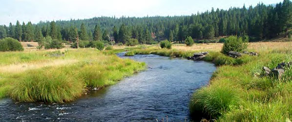
- John Day River Basin
Federal Columbia River Power System
Tributary Habitat Program — John Day River Basin
FCRPS Home | Hydrosystem | Hatcheries | Tributary Habitat Program | Tributary Habitat RME | Fish Accords
| General Documents | |
| 09/2013 | Middle Fork and Upper John Day River Tributary Assessments PDF 15.57 mb |
| 06/2008 | Upper John Day River Map Atlas PDF 2.59 mb |
| 06/2008 | Middle Fork Map Atlas PDF 22.18 mb |
| Middle Fork John Day | |
| 09/2013 | Geomorphology and Hydraulic Modeling of the Forrest Conservation Area PDF 12.10 mb |
| 09/2013 | Geomorphology and Hydraulic Modeling of the Forrest Conservation Area Appendices PDF 77.72 mb |
| 08/2010 | Forrest Conservation Area Reach Assessment Middle Fork John Day River PDF 11.9 mb |
| 03/2010 | Oxbow Conservation Area Reach Assessment Middle Fork John Day River PDF 10.42 mb |
Featured Project
Oxbow Project Details >>
Contact
Mark Croghan
John Day Subbasin Liaision
541-575-3033
mcroghan@usbr.gov
Bureau of Reclamation
Columbia-Pacific Northwest Region
431 Patterson Bridge Road
John Day OR, 97845
| Videos | Quick Reference | Acronyms & Terms |
