- Reclamation
- MP Region
- Area Offices
- KBAO
- Programs & Activities
- Water Operations
- Hydrology Database
Hydrology Database
Interactive map of the Klamath area showing the various data locations. Clicking on each location will provide the associated data. Text Version
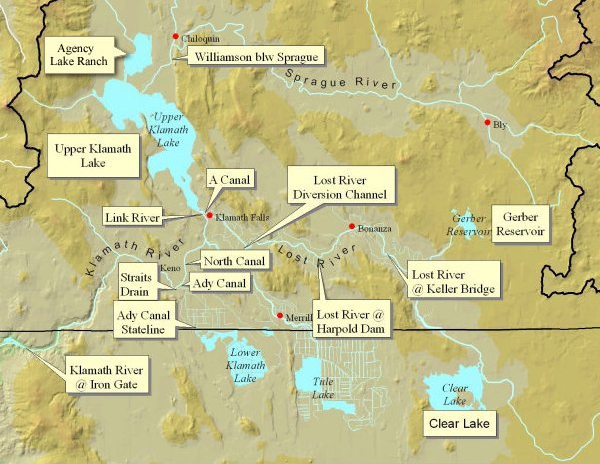
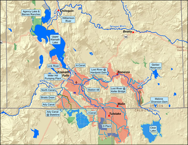
Note: The Klamath Basin Area Office collects data on Hydrology (water flows and levels) and Water Quality. Use the interactive map above or the text version to locate the information you are seeking
Provisional Data
The Bureau of Reclamation provides the information contained on this Web site as a courtesy and service to our customers. We offer a wide range of information, including links to other organizations' sites, to meet as many needs as possible. Reclamation makes every effort to provide accurate data according to the resources available to us. However, neither the authors, Reclamation, nor any other party involved in the preparation of the material and data available on or through this site represent that the information provided here is in every respect complete and accurate, and are not responsible for errors or omissions.
All "real-time" data available on the Reclamation WWW server are PROVISIONAL data that have not been reviewed or edited. These data are subject to change. Data users are cautioned to consider carefully the provisional nature of the information before using it.
