

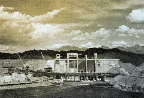
 The river is rising – but no cause for alarm. A lake 67 miles long is being created behind Davis Dam, shown with the stop logs in place, raising the water at the dam to a depth of 70 feet. The Arizona end of the dam is at the left.
By Russell K. Grater, Park Naturalist, Lake Mead Recreational Area, Arizona and Nevada
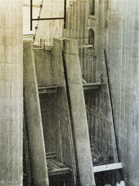
The concrete stop logs dropped into the spillway slots at Davis Dam.
 Bird's eye view of workmen lowering one of the 240 concrete stop logs (each 13 ½ feet long and weighing 6 tons) into one of the slots in the spillway of the dam.
Gradually, water began to rise behind the dam, covering an area which had been combed thoroughly by various members of the National Park Service for several years. Now the archaeologists and surveyors could give way to those who develop parks, picnic grounds, bathing, boating, fishing places, and other necessities of a Federal recreation area.
Davis Dam, located between Nevada and Arizona and 67 miles below Hoover Dam, the newest link in the chain of Reclamation structures on the Colorado River was backing up a startling expanse of bright cobalt blue which makes the traveler rub his eyes in disbelief as he suddenly comes upon this enormous, swiftly flowing, cold, blue river, in the midst of the parched desert.
Several years before construction work began on the dam, George F. Baggley, superintendent of the Lake Mead Recreation Area (of which this Davis Dam area is a part), set his crews to work investigating the shores.
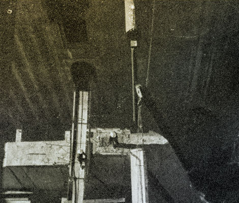 Stop log No. 202 going into place.
During the investigations, survey parties found more than a hundred ancient archeological sites along the river. These sites were once occupied by early day Indians who gave us what is known as the Patayan Culture. "Patayan" comes from a Walapai Indian term meaning the "Ancient Ones." Not much is known today about these early people, but they lived along the Colorado River Valley south of Hoover Dam as far as California and the Gulf. Large settlements were also located in western Arizona.
Most of these artifacts are stored at Boulder City, Nev., where they make up an extremely interesting and valuable collection. In time, many of them will be available for use in museum displays portraying the daily life of these Indians who lived along the Colorado.
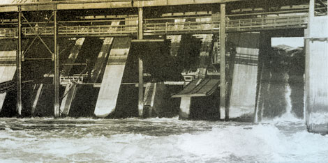 You can see the water flowing through the radial gate outlet at the right of the picture. The other outlet on the opposite side of the spillway is not in the photo. This operation backed up the river 30 miles.
Ring Bolt Rapids is where, in 1866, a steamboat was brought up the Colorado River as far as old Fort Callville – now deep under the water of Lake Mead. Chugging against the swift rapids was no easy task, so the crews drilled holes into the sheer rock above the stream, and fastened bolted rings at intervals along the canyon wall. They threaded ropes attached to the steamboat through a ring, fastened the ropes to a winch aboard the boat which then literally pulled itself up over the fast water. Today, these old rings are still found in place, and all available information and photographs are being obtained before they disappear under the new lake.
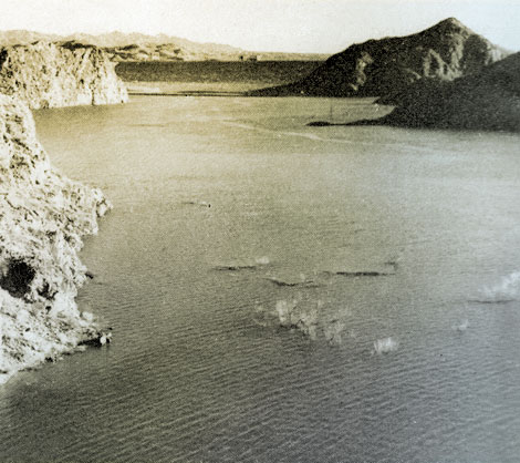 Each room with a view like this. The National Park Service photo above was taken from a spot close to the proposed lodge site at Katherine Wash as the new lake began to form behind Davis Dam.
A one-time oasis in the desert, richly green with palm and eucalyptus, later a wilderness of mesquite, arrow-wood and quailbrush, is now under many feet of water, but its story, too, has been salvaged by the National Park Service workers. Tatum Ranch on the Arizona side of the Colorado River was located a short distance downstream from Searchlight Ferry, and although now only a memory, it was well-known throughout the region in the early 1900s.
The National Park Service will preserve the archeological remains, the records of the iron rings along the river, the story of the Tatum Ranch, and other objects of historic interest that have been salvaged so that pages in the history of the Southwest will not be wholly lost.
Much remains to be done to make the Davis Dam area the outstanding recreational center it is destined to become, but it is now definitely out of the blueprint stage. How fast and how far the National Park Service can go in carrying out its plans depends to a great extent upon the availability of funds.
Source: The Reclamation ERA, April 1950
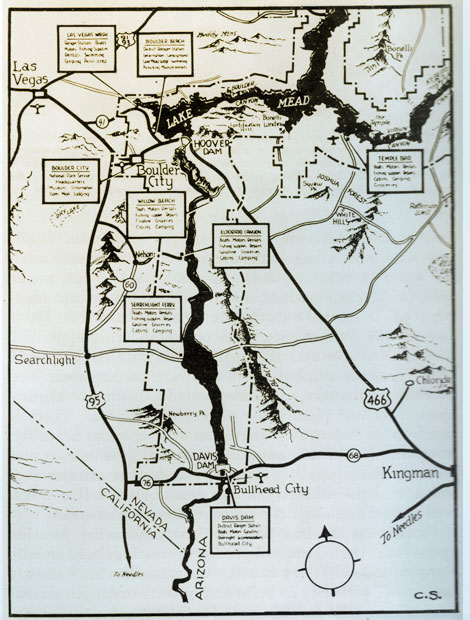 Map submitted through the courtesy of the National Park Service.
 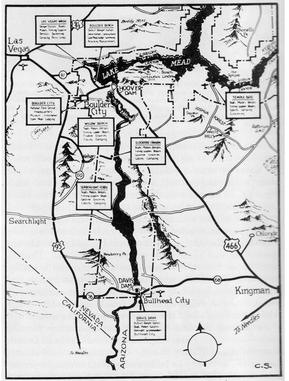 View large image
More information:
http://www.usbr.gov/lc/hooverdam/davisdam.html
http://www.usbr.gov/projects/Facility.jsp?fac_Name=Davis+Dam
http://www.recreation.gov/recAreaDetails.do?contractCode=NRSO&recAreaId=16&contractCode=129