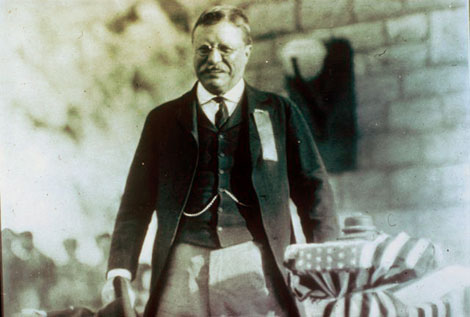
 President Theodore Roosevelt at the formal dedication of Roosevelt Dam, March 18, 1911. (Reclamation photograph)
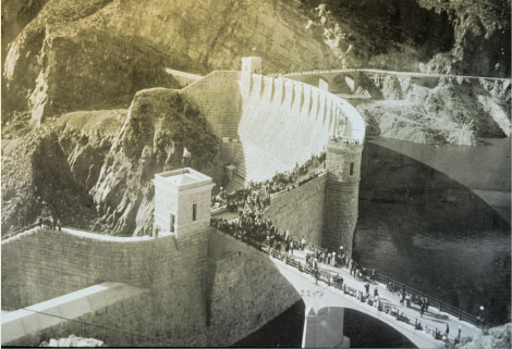 Crowds gathering at the finished dam to hear President Theodore Roosevelt speak at the formal dedication on March 18, 1911. (Reclamation photograph)
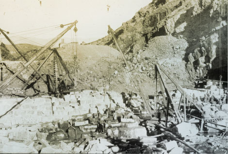 Excavation at dam site, 1906. (Reclamation photograph)
 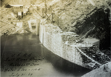 View of the dam, 1909. (Reclamation photograph)
 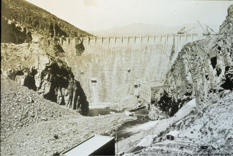 View of the dam nearing completion, 1910. (Reclamation photograph)
 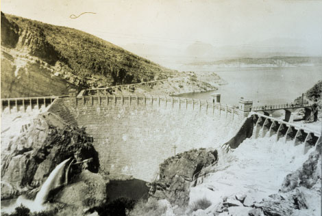 View of the completed dam looking upstream, 1923. (Reclamation photograph)
 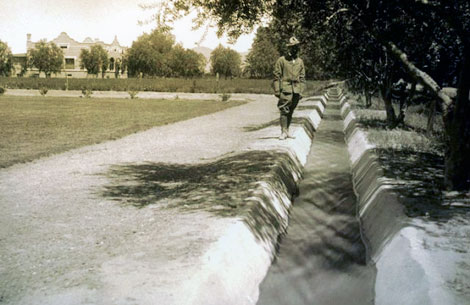 Improvements made to irrigation systems included lining laterals to conserve water, such as the cement-lined irrigation ditch on the Mallin Ranch about six miles north of Phoenix, 1910. (Reclamation photograph)
 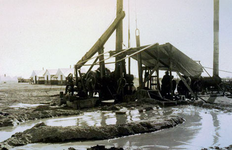 Drilling wells provided water for farmers, but by the second decade of the 20th century, farmland in the Salt River Valley was becoming saturated from too much irrigation. In this case, wells were drilled to remove water from water-logged fields, 1909. (Reclamation photograph)
 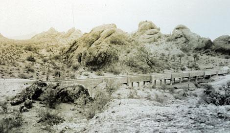 Near the end of the new Crosscut Canal a 500-foot-wide ravine required an elevated flume to carry water to the forebay before reaching the turbines at the hydro plant, 1914. (Reclamation photograph)
 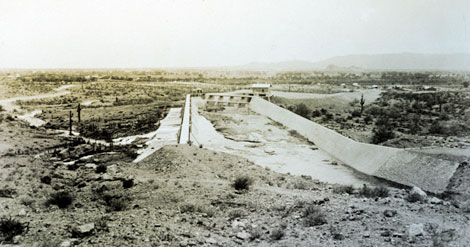 The purpose of the forebay was to hold a steady head of water for power generation. More importantly, it allowed the water to settle and drop its silt and sand to the bottom of the forebay where could be flushed out as necessary, 1914. (Reclamation photograph)
 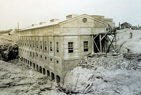 Construction of the Crosscut Powerhouse. Henry T. Cowling, 1914.
 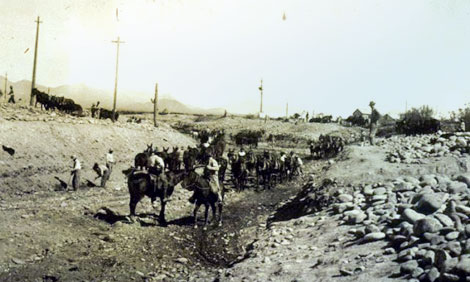 The Consolidated Canal was constructed in 1891 by the Consolidated Canal Company founded by A. J. Chandler. It extended the Mesa canal some 19 miles south to the boundary of the Gila River Indian Reservation. This 1920 photograph shows work being done on a portion of the canal. (Reclamation photograph)
 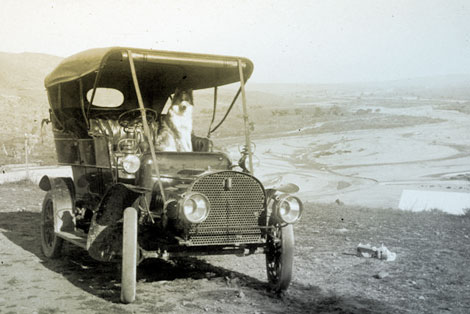 Lubken took this photo of his car and, presumably, his dog in March 1907 somewhere near the town of Roosevelt. The Salt River floodplain is in the background. (Reclamation photograph)
 -at-Arrowrock-Dam.jpg) Photographs of Walter Lubken are rare. In this photograph, Lubken is on the left holding a cigar. The photograph was taken at Arrowrock Dam, Idaho, in 1912. (Reclamation photograph)
Photographs of Walter Lubken are rare. In this photograph, Lubken is on the left holding a cigar. The photograph was taken at Arrowrock Dam, Idaho, in 1912. (Reclamation photograph) 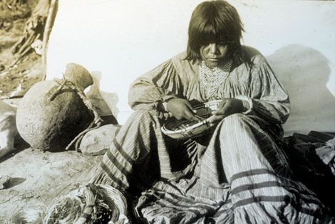 Lubken took a number of photographs of Western Apaches during his time at Roosevelt. Here is an Apache basketmaker, probably at an Apache camp located near the dam construction site. Apache workmen and their families lived in camps segregated from the other workers. (Reclamation photograph)
 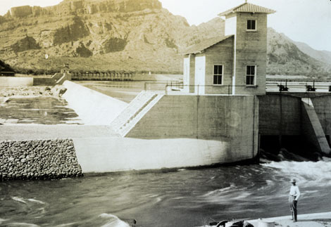 Granite Reef Diversion Dam is located east of Phoenix and diverts water from the Salt River into the Arizona and South canals on the north and south sides of the river, respectively. This 1910 photograph shows the water being diverted into the South Canal. (Reclamation photograph)
 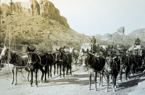 Lubken traveled repeatedly on the Mesa-Roosevelt road between the Salt River Valley and the dam site. At Government Wells where water was available, he captured supply wagons headed to the dam site in December 1907. (Reclamation photograph)
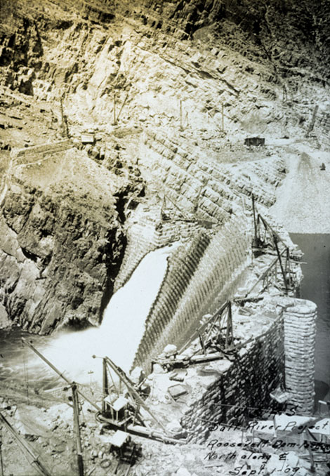 Lubken primarily documented the construction of Roosevelt Dam while in Arizona. This 1909 photograph shows the massive wall of the dam still under construction. (Reclamation photograph)
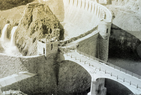
Roosevelt Dam is essentially completed in this photograph, probably taken in late 1910 or early 1911. (Reclamation photograph)
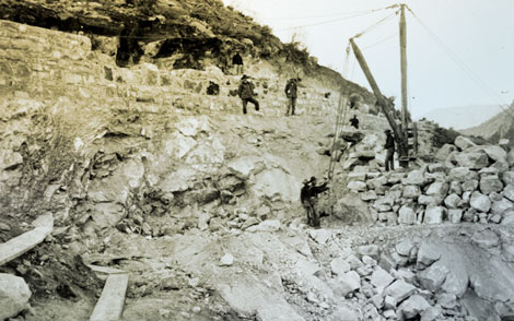 Cement was made at the dam site to save money by avoiding the cost of hauling it from Phoenix. In this 1904 photograph, Lubken captures construction workers building the cement plant. (Reclamation photograph)
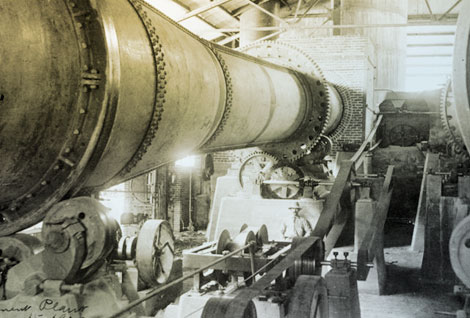 In 1905 Lubken photographed the interior of the newly finished cement plant. Lubken photographed many aspects of the different kinds of facilities that were built on or near the dam site such as the cement plant and a lumber mill in the mountains north of the dam. (Reclamation photograph)
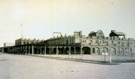 This 1914 photograph of the San Marcos Hotel in Chandler is one of numerous images by Lubken of the buildings, agriculture, canals, and places in the Salt River Valley. For a period of time, Lubken had a small shop in Mesa were he sold postcards of his images. (Reclamation photograph)
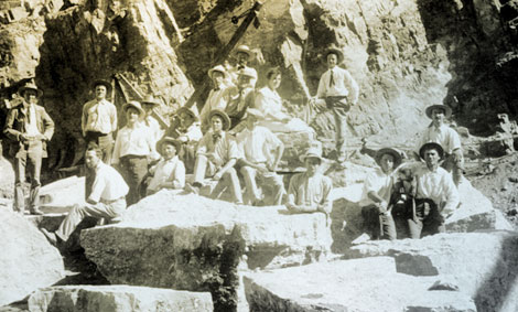 Roosevelt Dam was designed as a masonry dam that required each block of stone to be precisely cut and shaped. Stonemasons from around the world were sought out and hired for the demanding job. Masons of German, Scottish, Italian, and Swiss heritage worked on the dam. Here twenty-six Italian stonemasons from the East Coast pose for the Reclamation Service photographer Walter J. Lubken in 1906. (Reclamation photograph)
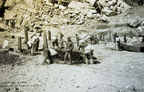 Workers from Arizona Territory—Black, Indian, Mexican, and Anglo—were joined by hundreds of other workers from numerous ethnic backgrounds from across the United States to work on Roosevelt Dam. Here they are pictured excavating the foundation for the dam, 1906. (Reclamation photograph)
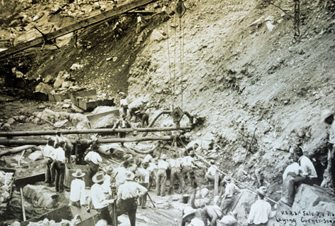
On September 20, 1906 workers ease the cornerstone of the dam into place. (Reclamation photograph)
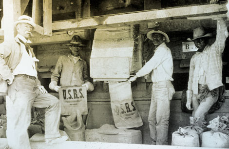 Because it was expensive to haul supplies from Mesa to the dam, the U.S. Reclamation Service built a cement plant on site, 1910. (Reclamation photograph)
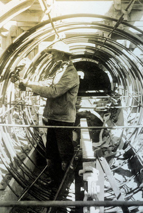 A hydropower plant provided electricity for the people building the dam and for running power equipment. Water for the generating units was brought via a diversion channel which crossed large drainages through a buried siphon. Here a workman is preparing the rebar frame for a siphon across Pinto Creek, 1905. (Reclamation photograph)
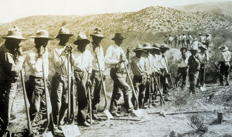 Apache workers built the road between Mesa and the dam site known as the Mesa–Roosevelt Road, 1907. By the 1920s it was called the “Apache Trail.” (Reclamation photograph)
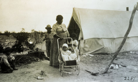 Like many Anglo workers, Apache families joined the men who worked on the dam. Apache families camped in segregated areas near the dam. (Reclamation photograph)
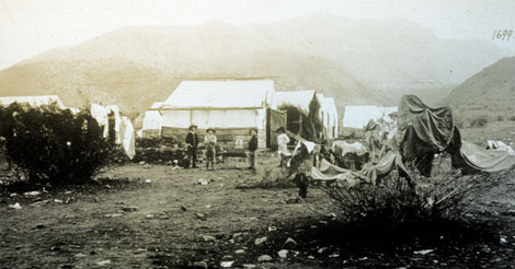 It's wash day in Roosevelt Town. Note the wood-framed tents used to house the workers' families, 1909. (Reclamation photograph)
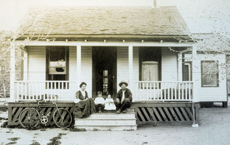 Luther Jackson and his family on the porch of their home, probably at Roosevelt. Luther was a ditch rider, most likely on the diversion canal that brought water to the generating plant. He was responsible for seeing that the canal worked as planned and was properly maintained, 1909. (Reclamation photograph)
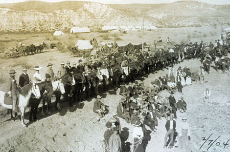 This 1904 photograph shows the dam builders assembled for a special event. The supervisors and engineers are on horseback, while workers and some of their wives sit or stand. (Reclamation photograph)
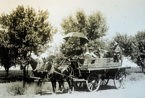 Citrus was a major economic crop in the Salt River Valley. Here, boxed citrus is ready for market. (Reclamation photograph)
 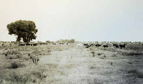 Alfalfa fields were common throughout the valley, and milk cows were another part of the valley economy. (Reclamation photograph)
 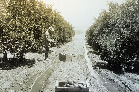 Citrus orchards dotted the valley once a reliable water supply was assured with the completion of Roosevelt Dam. (Reclamation photograph)
 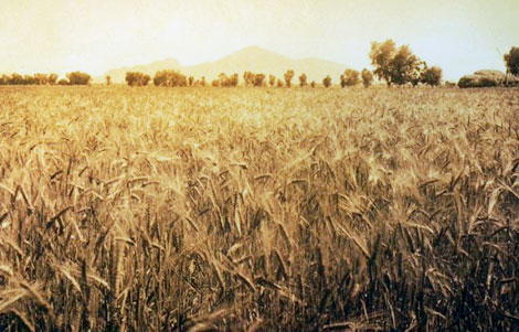 Amber waves of grain with Camelback Mountain on the horizon. (Reclamation photograph)
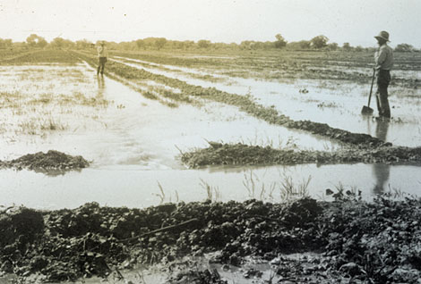
A reliable water supply allowed for flood irrigation of some fields. (Reclamation photograph)
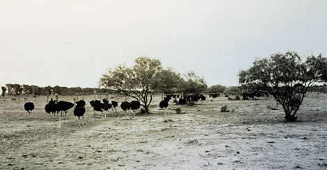 Raising ostriches for their feathers supplemented the income of Chandler farmers until fashions changed and ostrich feather hats went out of style. (Reclamation photograph)
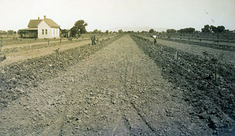 This sugar beet field was located in Glendale. Russian immigrants familiar with growing sugar beets were hired to tend the fields. (Reclamation photograph)
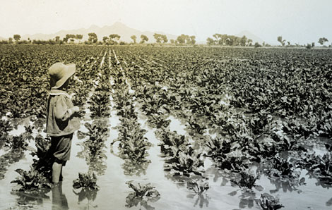 A young child stands ankle-deep in an irrigated field of what may be broad-leaf lettuce. (Reclamation photograph)
[ Return to Top ]


 President Theodore Roosevelt at the formal dedication of Roosevelt Dam, March 18, 1911. (Reclamation photograph)
 Crowds gathering at the finished dam to hear President Theodore Roosevelt speak at the formal dedication on March 18, 1911. (Reclamation photograph)
 Excavation at dam site, 1906. (Reclamation photograph)
  View of the dam, 1909. (Reclamation photograph)
  View of the dam nearing completion, 1910. (Reclamation photograph)
  View of the completed dam looking upstream, 1923. (Reclamation photograph)
  Improvements made to irrigation systems included lining laterals to conserve water, such as the cement-lined irrigation ditch on the Mallin Ranch about six miles north of Phoenix, 1910. (Reclamation photograph)
  Drilling wells provided water for farmers, but by the second decade of the 20th century, farmland in the Salt River Valley was becoming saturated from too much irrigation. In this case, wells were drilled to remove water from water-logged fields, 1909. (Reclamation photograph)
  Near the end of the new Crosscut Canal a 500-foot-wide ravine required an elevated flume to carry water to the forebay before reaching the turbines at the hydro plant, 1914. (Reclamation photograph)
  The purpose of the forebay was to hold a steady head of water for power generation. More importantly, it allowed the water to settle and drop its silt and sand to the bottom of the forebay where could be flushed out as necessary, 1914. (Reclamation photograph)
  Construction of the Crosscut Powerhouse. Henry T. Cowling, 1914.
  The Consolidated Canal was constructed in 1891 by the Consolidated Canal Company founded by A. J. Chandler. It extended the Mesa canal some 19 miles south to the boundary of the Gila River Indian Reservation. This 1920 photograph shows work being done on a portion of the canal. (Reclamation photograph)
  Lubken took this photo of his car and, presumably, his dog in March 1907 somewhere near the town of Roosevelt. The Salt River floodplain is in the background. (Reclamation photograph)
 -at-Arrowrock-Dam.jpg) Photographs of Walter Lubken are rare. In this photograph, Lubken is on the left holding a cigar. The photograph was taken at Arrowrock Dam, Idaho, in 1912. (Reclamation photograph)
Photographs of Walter Lubken are rare. In this photograph, Lubken is on the left holding a cigar. The photograph was taken at Arrowrock Dam, Idaho, in 1912. (Reclamation photograph)  Lubken took a number of photographs of Western Apaches during his time at Roosevelt. Here is an Apache basketmaker, probably at an Apache camp located near the dam construction site. Apache workmen and their families lived in camps segregated from the other workers. (Reclamation photograph)
  Granite Reef Diversion Dam is located east of Phoenix and diverts water from the Salt River into the Arizona and South canals on the north and south sides of the river, respectively. This 1910 photograph shows the water being diverted into the South Canal. (Reclamation photograph)
  Lubken traveled repeatedly on the Mesa-Roosevelt road between the Salt River Valley and the dam site. At Government Wells where water was available, he captured supply wagons headed to the dam site in December 1907. (Reclamation photograph)
 Lubken primarily documented the construction of Roosevelt Dam while in Arizona. This 1909 photograph shows the massive wall of the dam still under construction. (Reclamation photograph)
 Roosevelt Dam is essentially completed in this photograph, probably taken in late 1910 or early 1911. (Reclamation photograph)
 Cement was made at the dam site to save money by avoiding the cost of hauling it from Phoenix. In this 1904 photograph, Lubken captures construction workers building the cement plant. (Reclamation photograph)
 In 1905 Lubken photographed the interior of the newly finished cement plant. Lubken photographed many aspects of the different kinds of facilities that were built on or near the dam site such as the cement plant and a lumber mill in the mountains north of the dam. (Reclamation photograph)
 This 1914 photograph of the San Marcos Hotel in Chandler is one of numerous images by Lubken of the buildings, agriculture, canals, and places in the Salt River Valley. For a period of time, Lubken had a small shop in Mesa were he sold postcards of his images. (Reclamation photograph)
 Roosevelt Dam was designed as a masonry dam that required each block of stone to be precisely cut and shaped. Stonemasons from around the world were sought out and hired for the demanding job. Masons of German, Scottish, Italian, and Swiss heritage worked on the dam. Here twenty-six Italian stonemasons from the East Coast pose for the Reclamation Service photographer Walter J. Lubken in 1906. (Reclamation photograph)
 Workers from Arizona Territory—Black, Indian, Mexican, and Anglo—were joined by hundreds of other workers from numerous ethnic backgrounds from across the United States to work on Roosevelt Dam. Here they are pictured excavating the foundation for the dam, 1906. (Reclamation photograph)
 On September 20, 1906 workers ease the cornerstone of the dam into place. (Reclamation photograph)
 Because it was expensive to haul supplies from Mesa to the dam, the U.S. Reclamation Service built a cement plant on site, 1910. (Reclamation photograph)
 A hydropower plant provided electricity for the people building the dam and for running power equipment. Water for the generating units was brought via a diversion channel which crossed large drainages through a buried siphon. Here a workman is preparing the rebar frame for a siphon across Pinto Creek, 1905. (Reclamation photograph)
 Apache workers built the road between Mesa and the dam site known as the Mesa–Roosevelt Road, 1907. By the 1920s it was called the “Apache Trail.” (Reclamation photograph)
 Like many Anglo workers, Apache families joined the men who worked on the dam. Apache families camped in segregated areas near the dam. (Reclamation photograph)
 It's wash day in Roosevelt Town. Note the wood-framed tents used to house the workers' families, 1909. (Reclamation photograph)
 Luther Jackson and his family on the porch of their home, probably at Roosevelt. Luther was a ditch rider, most likely on the diversion canal that brought water to the generating plant. He was responsible for seeing that the canal worked as planned and was properly maintained, 1909. (Reclamation photograph)
 This 1904 photograph shows the dam builders assembled for a special event. The supervisors and engineers are on horseback, while workers and some of their wives sit or stand. (Reclamation photograph)
 Citrus was a major economic crop in the Salt River Valley. Here, boxed citrus is ready for market. (Reclamation photograph)
  Alfalfa fields were common throughout the valley, and milk cows were another part of the valley economy. (Reclamation photograph)
  Citrus orchards dotted the valley once a reliable water supply was assured with the completion of Roosevelt Dam. (Reclamation photograph)
  Amber waves of grain with Camelback Mountain on the horizon. (Reclamation photograph)
  A reliable water supply allowed for flood irrigation of some fields. (Reclamation photograph)
 Raising ostriches for their feathers supplemented the income of Chandler farmers until fashions changed and ostrich feather hats went out of style. (Reclamation photograph)
 This sugar beet field was located in Glendale. Russian immigrants familiar with growing sugar beets were hired to tend the fields. (Reclamation photograph)
 A young child stands ankle-deep in an irrigated field of what may be broad-leaf lettuce. (Reclamation photograph)