

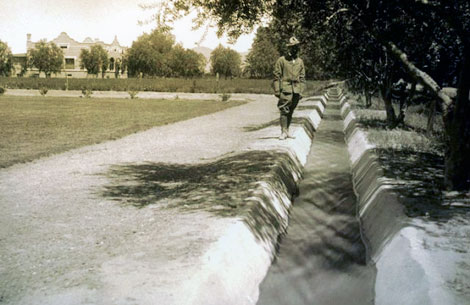
 Improvements made to irrigation systems included lining laterals to conserve water, such as the cement-lined irrigation ditch on the Mallin Ranch about six miles north of Phoenix, 1910. (Reclamation photograph)
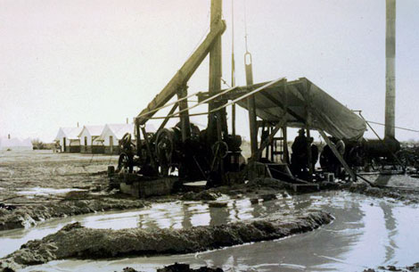 Drilling wells provided water for farmers, but by the second decade of the 20th century, farmland in the Salt River Valley was becoming saturated from too much irrigation. In this case, wells were drilled to remove water from water-logged fields, 1909. (Reclamation photograph)
With completion of Roosevelt Dam, a new era began for the Reclamation Service and the Salt River Valley Water Users Association. Once the congratulatory trumpets silenced and the civic parades ended, reality set in, in the form of hard feelings between the Association and Reclamation over Roosevelt's excessive construction costs. Faced with huge repayment costs, the Association complained to the Interior Secretary, who appointed a board to oversee the matter. The board determined Roosevelt's total costs to be nearly $13 million which, after much haggling, was whittled down to $10.79 million. This prompted Interior to suggest that a contract should be drawn up that would allow the landowners to assume control of the project. On September 6, 1917, a contract was signed, and the Association took control of the project's two dams and all irrigation canals and ditches. The Association was now responsible for future operation and maintenance expenditures, as well as construction repayment costs. The government retained ownership of the Salt River Project.
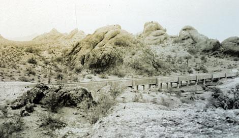 Near the end of the new Crosscut Canal a 500-foot-wide ravine required an elevated flume to carry water to the forebay before reaching the turbines at the hydro plant, 1914. (Reclamation photograph)
Project farmers had another problem: waterlogged lands—possibly the same problem the Hohokam faced before abandonment. Before 1911, very few areas in the valley required drainage. By 1916, extensive irrigation, provided by an improved storage, diversion, and delivery system, resulted in waterlogged lands with inadequate pumping and insufficient drainage. In 1917, Reclamation and the Association researched drainage by pumping, and concluded it was feasible to do so. Beginning in 1917 and lasting into the next decade, the Association drilled new wells, resulting in more water that was made available for irrigation.
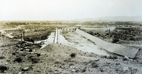 The purpose of the forebay was to hold a steady head of water for power generation. More importantly, it allowed the water to settle and drop its silt and sand to the bottom of the forebay where could be flushed out as necessary, 1914. (Reclamation photograph)
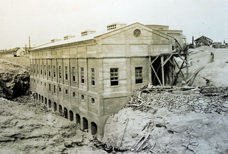 Construction of the Crosscut Powerhouse. Henry T. Cowling, 1914.
During this period, the Federal Government aggressively stepped in to purchase and improve the existing canal system as well as work with the Association to build new canals. Enhancing and unifying the canal system was an important goal for the Reclamation Service and the Association. In 1906, the Federal Government purchased the Grand, Arizona, and Crosscut canals on the north side of the Salt River. In 1908 the federal government purchased the Consolidated Canal on the south side to unify the water distribution system on the valley's southern and eastern reaches. The South Canal was built by the Government from 1906 to 1908, while the Eastern Canal (1909) replaced the old Highland Canal ¼ mile to the west, opening more to irrigation lands in east Mesa and Gilbert. From 1912 to 1913, the Association (under contract with the federal government) constructed a new Crosscut Canal to tie the Arizona Canal to the Grand Canal. A hydropower plant was constructed on the Crosscut Canal to take advantage of the 112-foot elevation drop on the canal and generate additional electric power. This project was part of a larger hydropower project that saw development of a hydro plant on the South Canal and refurbishment of the existing Arizona Falls hydro plant. The final major canal constructed during this period was the Western Canal, which ran from the Consolidated Canal in Gilbert west and north of South Mountain to 19th Avenue in Phoenix.
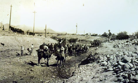 The Consolidated Canal was constructed in 1891 by the Consolidated Canal Company founded by A. J. Chandler. It extended the Mesa canal some 19 miles south to the boundary of the Gila River Indian Reservation. This 1920 photograph shows work being done on a portion of the canal. (Reclamation photograph)
The system's unification and improvements stabilized the valley's canal landscape, resulting in a more efficient irrigation system to support a growing agricultural economy for the new state.
Modified and adapted from: National Register of Historic Places Multiple Property Documentation Form, Salt River Project, Arizona, prepared by Jim Bailey, Bureau of Reclamation June 2010; The Bureau of Reclamation: Origins and Growth to 1945, Volume 1. William D. Rowley, Bureau of Reclamation, Denver, 2006.