- Reclamation
- Missouri Basin and Arkansas-Rio Grande-Texas Gulf
- Multimedia
- Lewis and Clark: A Missouri River Adventure
Lewis and Clark: A Missouri River Adventure
On May 14, 1804, Meriwether Lewis, William Clark and their group of 40 men, collectively known as the Corps of Discovery, launched their pirogues and keelboat onto the Missouri River at its mouth, some 18 miles from the young town of St. Louis.
Since officially embarking on this expedition in Pittsburgh on August 31, 1803, they had already traveled by land and down two other rivers, the Ohio and the Wood, to get to the confluence of the Missouri and Mississippi rivers.
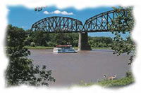
The Missouri River in North Dakota
-Photo Courtesy of North Dakota Tourism
On this day in May, they began navigating their boats up what was to be the nearly 2,500 miles of this river named for the Indian nation which lived near its confluence with the Mississippi. Here they began the segment of their journey that was considered the major purpose of this extraordinary journey.
"The object of your mission is to explore the Missouri river, & such principal stream of it, as, by it's course and communication with the waters of the Pacific ocean, whether the Columbia, Oregen, Colorado or any other river may offer the most direct & practicable water communication across this continent for the purposes of commerce."
These instructions were among the extensive orders that Commander-In-Chief Jefferson had written for the Corps of Discovery before the group left on its trip.
Jefferson's orders continued: "Beginning at the mouth of the Missouri, you will take careful observations of latitude & longitude, at all remarkable points on the river, & especially at the mouths of rivers, at rapids, at islands, & other places & objects distinguished by such natural marks & characters of a durable kind."
Well prepared to carry out these orders, the Corps of Discovery had among its ranks interpreters, fur trappers, hunters, boat builders, blacksmiths, gunsmiths, carpenters, surveyors and millers. Lewis himself had been trained by the country's leading scientists in botany, zoology, celestial navigation and medicine. Clark had a long career as a militiaman and army officer, and one of his most valuable skills for this expedition was that of cartography - making maps.
They traveled as few as 5 and as many as 20 miles a day - a distance of 14 miles a day was considered good - with Clark often staying in a boat and Lewis walking along the shore. They carefully observed what was unfolding before them, sketching diagrams of plants and animals and fastidiously recording what they gathered at the end of each day.
Expedition members discovered 178 plant species, 122 animal species and documented 50 Indian tribes, 24 of which had never seen a white man. They also chronicled their expedition in journals, written by several members, recording both the thrilling and the mundane of this two-and-a-half year journey. They carried maps from others who had traveled upstream as far as the confluence of the Missouri with the Yellowstone River, which is located in today's northwestern corner of North Dakota near the Montana border. However, beyond this point, they were the first Americans and are considered to be among the first white men to pass through much the rest of the land the Corps of Discovery traveled.
