- Reclamation
- Missouri Basin
- HydroMet
- Monthly Data Request (RES070)
Monthly Data Request (RES070)
(Monthly data for one station, one parameter, period of record)
This form outputs a table of monthly data for one station, one parameter, listed by water year for any length of time up to the period of record. Monthly data parameters are different from Archive and Dayfile parameters. See the table below for a sample list of some common parameters. Selecting a station from the dropdown menu and then typing "LIST" into the parameter input box will list all parameters for the selected station. In addition to outputting monthly data, the output also includes mean, maximum, and minimum values for period of interest.
Common Monthly Parameters can be found in the table below:
| Parameter Code | Description |
|---|---|
| AF.EOM | Reservoir End-Of-Month Content (acre-feet) |
| AF.EV | Monthly Evaporation Loss (acre-feet) |
| AF.EVF | Monthly Evaporation Factor (acre-feet) |
| AF.GAIN | Monthly River Basin Gain between designated stations (acre-feet |
| AF.GAIN2 | Monthly River Basin Gain between BBR/BOYR and BHR (acre-feet) |
| AF.GAINX | Monthly Computed Gain Using USGS Records (acre-feet) |
| AF.ID | Monthly Manually Entered Inflow (acre-feet) |
| AF.IN | Monthly Computed Inflow (acre-feet) |
| AF.INX | Monthly Computer Inflow Using USGS Records (acre-feet) |
| AF.QD | Monthly Total Discharge (acre-feet) |
| AF.QDX | WATSTOR Total Monthly Discharge (acre-feet) |
| AF.QED | Monthly Power Turbine Discharge (acre-feet) |
| AF.QJ | Monthly Canal Discharge (acre-feet) |
| AF.QRD | Monthly River Discharge (acre-feet) |
| AF.QROD | Monthly Regulating Outlet Discharge (acre-feet) |
| AF.QSD | Monthly Spillway Discharge (acre-feet) |
| CFS.QRD | Monthly River Discharge Average (cfs) |
| FB.EOM | Reservoir End-Of-Month Forebay Elevation (feet) |
| PP.MON | Monthly Total Precipitation (inches) |
| SE.EOM | Snow Water Equivalent End-of-Month (inches) |
| VG | Monthly Total Energy Generation (gwh) |
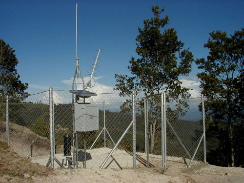
An example of an automated hydrologic and meteorologic monitoring (Hydromet) station that are located throughout the Missouri Basin Region.
