- Reclamation
- Pacific Northwest Region
- Grand Coulee Dam
- History
- Natural History
Natural History Photo Gallery
Grand Coulee Dam is positioned in an area which sits on the edge of two geologic zones – the Okanogan Highlands and the Columbia Plateau. The dam sits on the solid granitic rock of the Okanogan Highlands, making a perfect base for the dam. The Columbia Plateau to the South consists of layers of softer basalts.
The Columbia River in the Grand Coulee region was carved between these two geologic zones. The landscape that is currently visible in the area is the result of the most recent Ice Age Floods which shaped this landscape approximately 13,000 years ago.
Grand Coulee Dam is located in the shrub-steppe ecosystem. Plants in this area have adapted to hot dry summers and cold winters. Being in the rainshadow of the Cascade Mountain Range, the average precipitation is 7 - 10 inches per year. The shrub-steppe ecosystem supports a wide variety of plants and animals including the dominant sagebrush and bunchgrasses. The soil consists of rich loess that consists of glacial windblown clay, dust and silt. It is the loess, combined with an adequate amount of water supplemented by irrigation that makes the irrigation of the Columbia Basin Project productive.
| Related Documents | |||
| 04/15/2015 | Geology of the Grand Coulee Dam Area PDF 267 kb | ||
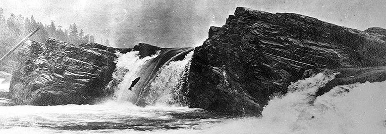
| 01/1938 | Report of the Preliminary Investigations into the Possible Methods of Preserving the Columbia River Salmon and Steelhead at Grand Coulee Dam PDF 25.68 mb | ||
| Related Links |
| Photo Gallery (HTML) |
| Ice Age Floods |
| The Confederated Tribes of the Colville Reservation (HTML) |
| Spokane Tribe of Indians (HTML) |
| Grand Coulee Dam: The American Experience (PBS.org) (HTML) |
| Spokane Historical (HTML) |
| Grand Coulee Dam: Leaving a Legacy (HTML) |
| National Park Service (HTML) |
