

 The extended drought in the Southwest motivated Reclamation to develop a thoughtful plan to address the challenges posed by possible water shortages. (Reclamation photograph)
Managing Drought and Water Shortages for Arizona and Other Lower Colorado River States
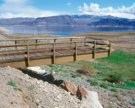 A once popular fishing pier stretches over dry land far from the water's edge at Lake Mead. (Reclamation photograph)
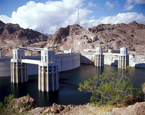
Over 27 million people rely on the Colorado River for drinking water. The river irrigates over 3.5 million acres of farmland; the Colorado River is the single most important natural resource in the Southwest. The effects of a multi-year drought have had a tremendous impact on the amount of Colorado River water that can be stored for public use. As of 2005, the total system storage on the Colorado River had decreased by more than 40% over several years. This is the first long-term drought in the modern history of the Colorado River, although climate experts and scientists suggest droughts of this severity have occurred in the past and are likely to occur in the future.
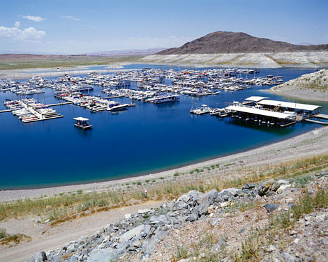 This marina in Lake Mead was relocated in 2006 as lowering reservoir levels closed off the cove's access to the lake. The years 2000-2010 were the driest 11-year period in the 100-year historical record of the Colorado River. (Reclamation photograph)
The declining reservoir levels in the Lower Colorado Basin have led to interstate and inter-basin tensions. While water storage in the massive Southwestern reservoirs afforded great protection against the drought, demand exceeds supply. The Department of the Interior recently set a goal to have detailed, objective planning tools in order to be ready to make informed operational decisions if the reservoirs continued to decline.
In May 2005, the Secretary of the Interior directed Reclamation to develop additional strategies for improving coordinated management of the reservoirs of the Colorado River system. In response, Reclamation initiated a public process to develop and adopt interim operational guidelines that can be used to address the operations of Lake Powell and Lake Mead during drought and low reservoir conditions.
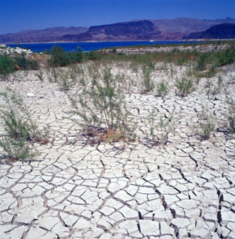 Between January 2000 and December 2010, Lake Mead dropped nearly 128 feet, exposing acres of land that were previously covered by water. (Reclamation photograph)
Each year, the Secretary is required to declare the Colorado River water supply availability conditions for the Lower Basin States as Normal, Surplus, or Shortage. While regulations and operations criteria have been developed for Normal and Surplus conditions, detailed guidelines for a water supply shortage have never been established. The development of these guidelines has been spurred by the current multi-year drought, a decrease in the amount of stored water, and growing demands for Colorado River water.
The Colorado River entitlement priority system is important to Arizona, especially when the river system's water storage is insufficient to meet the downstream demand of the Lower Basin states. During the last decade, extremely dry conditions led to the development of criteria for reducing water deliveries during periods of shortage. In December, 2007, the Secretary of Interior adopted the first shortage criteria developed for the Colorado River.
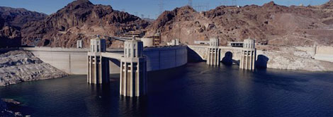
 In November 2010, Lake Mead fell to elevation 1081.85, the lowest level ever reached since the lake began filling in 1935. (When full, the reservoir is at elevation 1219 feet above sea level.) (Reclamation photograph)
If the elevation of Lake Mead is projected to be at or below 1,075 feet, and above 1,050 feet, Arizona's Colorado River water deliveries will be reduced by 320,000 acre-feet. If Mead drops below 1,050 feet, and is at or above 1,025 feet, Arizona's supply will be reduced by 400,000 acre-feet. If Lake Mead drops below 1,025 feet, Arizona's supply will be reduced by 480,000 acre-feet. Furthermore, the Basin States will consult with the Secretary annually to determine whether hydrologic conditions coupled with the projected annual Lower Basin water deliveries could cause Lake Mead's elevation to drop below 1,000 feet and to discuss further measures that will be taken.
By developing these focused guidelines, the Secretary will be in a better position to manage and operate the key Colorado River reservoirs while also providing U.S. Colorado River water users and managers of the Colorado River Basin (which includes Arizona) greater assurance with respect to the amount of annual water deliveries in future years, particularly in times of drought and when reservoirs are low.
More Information:
http://www.usbr.gov/lc/region/programs/strategies.html
http://www.usbr.gov/lc/region/programs/strategies/documents.html
http://www.adwr.state.az.us/AzDWR/StateWidePlanning/CRM/FutureWaterDistribution.htm