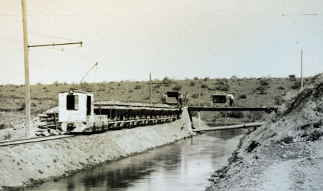
 An electric engine is hauling cars filled with clay for use in the construction of Roosevelt Dam. The tracks are adjacent to the power canal that was built to divert water from the Salt River and carry it to a penstock near the dam site where it fell 220 feet to power a water turbine. The penstock and turbine were temporarily located in small cave south of and below the dam site. Electricity generated by the turbine provided power for this engine and a host of other tools and appliances at the dam site and the nearby town of Roosevelt, 1905. (Restoration photograph)
 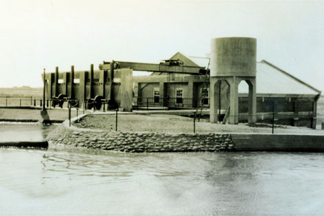 In the late 1800s, Phoenicians enjoyed the wonders of Arizona Falls, gathering there to picnic, socialize, and dance near the cool water. Located on the Arizona Canal between 56th and 58th Streets, Arizona Falls, built in 1902, was the first hydroelectric plant in Phoenix. Here the Arizona Canal drops 20 feet, and it was this falling water that was harnessed to produce power. The hydroelectric plant was one of four such plants located on canals in the valley. (SRP photograph)
 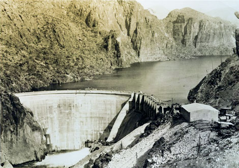 Constructed by the Salt River Valley Water User's Association between 1923 and 1925, Mormon Flat Dam was the first facility in the Association's privately-funded hydropower expansion program. It was built for the dual purposes of generating hydroelectric power and for storing approximately 57,000 acre-feet of water in its reservoir, Canyon Lake, for agricultural and urban/commercial uses in the Salt River Valley. In a radical departure from the design used by the U. S. Reclamation Service for Roosevelt Dam, C.C. Cragin designed a concrete, thin-arch structure with a height (streambed to crest) of 224 feet. The dam's crest is 380 feet long, with a top width of 8 feet and a maximum base width of 20 feet. (SRP photograph)
 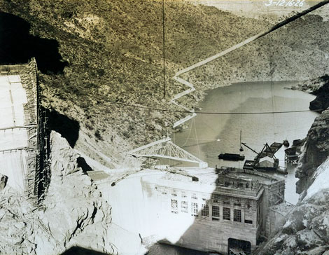 As the second dam constructed from 1924 to 1927 by the Salt River Valley Water Users Association, Horse Mesa Dam was to provide inexpensive power to the copper mines of Globe and Miami. Financing from Inspiration Consolidated Copper Company allowed for construction, and the Company agreed to purchase all the Horse Mesa's power. The dam was designed by C. C. Cragin and Bureau of Reclamation engineers. The result was a concrete thin-arch dam standing 305 feet high from bedrock to the top of the coping and a crest length of 660 feet. Thickness at the base varies from 43 to 57 feet, with the dam being 8 feet thick at the top. The arch's maximum span is 450 feet. (SRP photograph)
 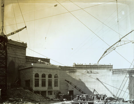 Stewart Mountain Dam is a 207-foot-high, reinforced concrete radius, thin-arch dam consisting of a single arch flanked on both sides by gravity buttresses or abutments, with a gravity overflow spillway on the east side. The main arch stretches 480 feet from buttress to buttress and varies in thickness from eight feet at the crest to 33 feet at the deepest foundation. Built between 1928 and 1930, it was the last of the dams built by the Salt River Valley Water Users Association to provide both power and irrigation water to Valley residents. (SRP photograph)
 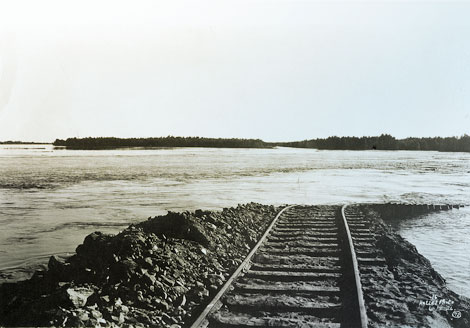 Flooding of the Imperial Valley in California during 1902-1905, when the Colorado River broke through its embankment, contributed to the decision to build a dam on the river. (Reclamation photograph)
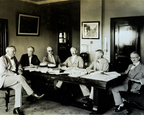 The Colorado River Commission, with Secretary of Commerce Herbert Hoover serving as chairman, met in Santa Fe, New Mexico, in the Fall of 1922. Here, during a sometimes contentious meeting, they hammered out an agreement governing future water rights allocation on the Colorado River. The resulting Colorado River Compact divided the river into an "Upper Basin" comprised of Wyoming, Colorado, Utah, and New Mexico and a "Lower Basin" comprised of Nevada, Arizona, and California that lies downstream from Lee's Ferry near the Utah/Arizona border. (Reclamation photograph)
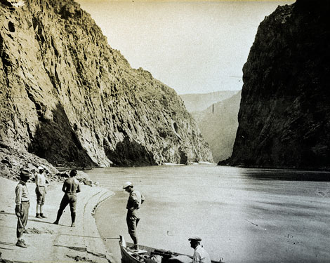 Both Boulder Canyon and Black Canyon (pictured) offered dramatic, narrow gorges with steep walls climbing upwards from the river for hundreds of feet. By 1924, a dam site in Black Canyon was determined to be the preferred choice. The new location provided a larger reservoir pool and would be less costly to construct based on anticipated savings in material and logistical expenses. (Reclamation photograph)
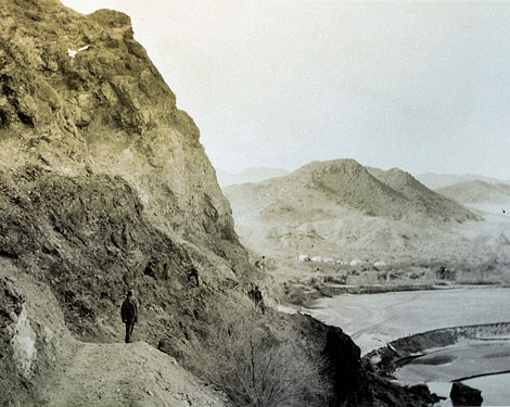 Black canyon dam site with beginnings of a construction camp in the background. (Reclamation photography)
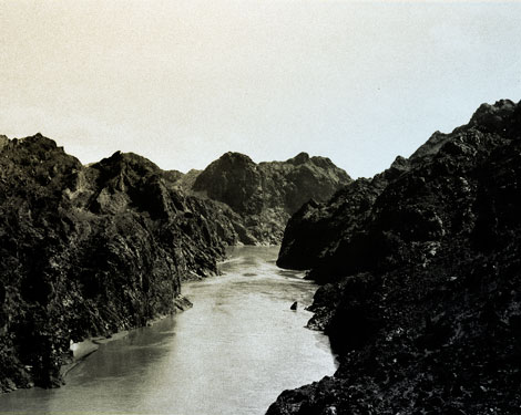 View of Black Canyon. (Reclamation photograph)
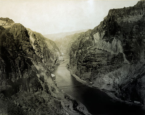 This photograph shows preliminary work on the Black Canyon site. Note portals to tunnels No.2, No. 3, and No. 4. In the upper left, a retaining wall on the road to dam, can be seen. The dam site is located at the uppermost bridge crossing the river. (Reclamation photograph)
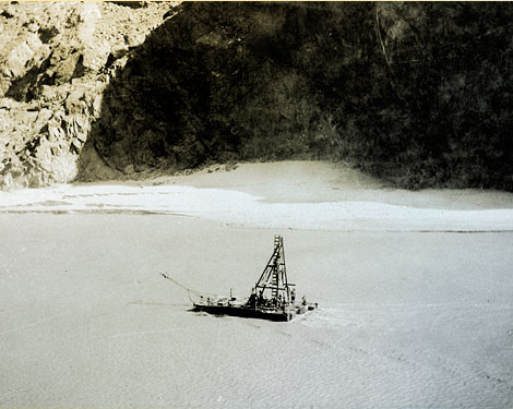 A 1922 photograph shows a barge with a drill testing the river bed to assess its composition and structure. (Reclamation photograph)
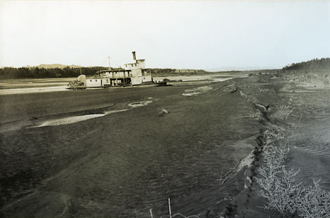 When the Colorado River drained into the Imperial Valley, this steamboat was left high and dry on the river. (Reclamation photograph)
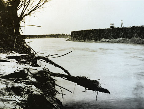 Serious erosion along the banks of the Colorado occurred when the river overflowed. (Reclamation photograph)
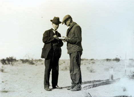 A farmer and the Project Manager close a deal on a farm plot on Yuma Mesa. No date. (Reclamation photograph)
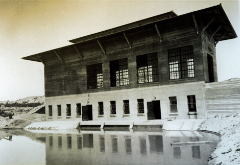 This 1922 photograph shows the forebay of the new power plant for the pump station constructed at the base of Yuma Mesa. (Reclamation photograph)
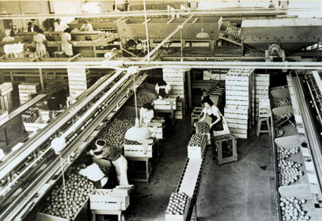 Citrus packing shed of the Yuma Mesa Fruit Growers where workers grade and package fruit after it has traveled via a conveyor belt through cleaning and washing machines. (Reclamation photograph)
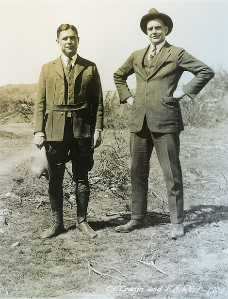 Superintendent Charles C. Cragin (left) and SRP President Frank Reid played key roles in moving the Salt River Valley Water Users' Association into the power generation business. Cragin's plan for building three new dams on the lower Salt River ensured that the Association would become a major hydroelectric supplier for the Salt River Valley. (SRP photograph)
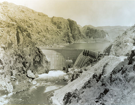 Mormon Flat Dam was the first of the hydroelectric dams to be built on the Salt River. (SRP photograph)
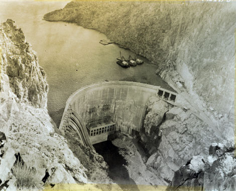 The second dam to be built by the Association was Horse Mesa Dam, located between Mormon Flat and Roosevelt dams. (SRP photograph)
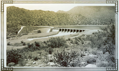 Stewart Mountain Dam was the last dam to be built, completing the Association's decade-long effort to increase power generation. (SRP photograph)
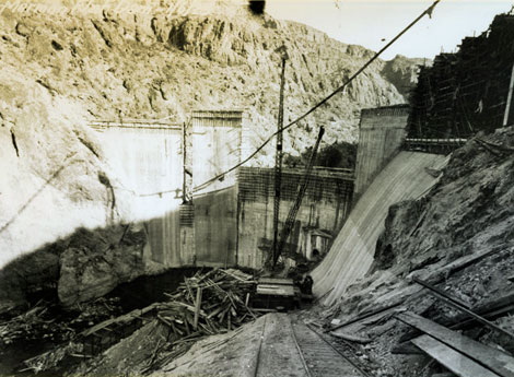 Mormon Flat Dam under construction 1925 (SRP photograph).
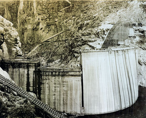 Horse Mesa Dam looking downstream, 1927. (SRP photograph)
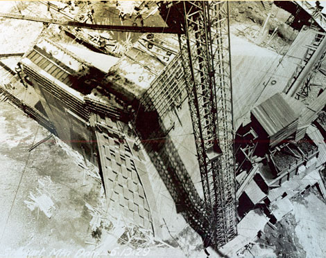 Construction of Stewart Mountain Dam, 1929. (SRP photograph)
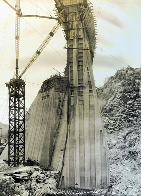 Stewart Mountain Dam construction, 1929. (SRP photograph)
[ Return to Top ]