About the Central Valley Project
General Description
California's Central Valley Basin is surrounded by mountains except for a gap in its western edge (the Carquinez Strait). The valley floor occupies about one-third of the basin, the other two-thirds is mountainous. Running north and east, the Cascade Range and Sierra Nevada Mountains rise to about 14,000 feet. On the west, the Coast Range rises to 8,000 feet.
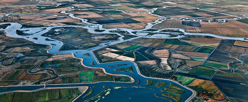
The basin includes two major watersheds—the Sacramento River in the north and the San Joaquin River in the south, including the Tulare Lake Basin. The combined watersheds extend nearly 500 miles from northwest to southeast and range from about 60 to 100 miles wide. The San Joaquin River, which runs northward, has tributaries that generally run east and west. The upper basin of the Sacramento River, which runs southward, yields larger run-off per square mile than any other section of the state (except for a few locations along the north Pacific Coast). These two river systems join at the Sacramento-San Joaquin River Delta and flow through Suisun Bay and Carquinez Strait, into San Francisco Bay, and then into the Pacific Ocean via the Golden Gate strait.
This multiple-purpose project plays a key role in California’s powerful economy, providing water for 7 of the top 10 agricultural counties in the nation’s leading farm state. It has been estimated that the value of crops and related service industries has returned 100 times Congress’ $3 billion investment in the CVP. About 60 percent of the cost of the CVP was allocated to irrigation and municipal and industrial water with the remainder to other beneficial uses.
The CVP
- Reaches some 400 miles, from the Cascade Mountains near Redding in the north to the Tehachapi Mountains near Bakersfield in the south.
- Consists of *20 dams and reservoirs, 11 powerplants, and 500 miles of major canals, as well as conduits, tunnels, and related facilities. *This number changes over the years as ownership changes.
- Manages some 9 million acre-feet of water.
- Annually delivers about 7 million acre-feet of water for agricultural, urban, and wildlife use.
- Provides about 5 million acre-feet for farms -- enough to irrigate about 3 million acres, or roughly one-third of the agricultural land in California.
- Furnishes about 600,000 acre-feet for municipal and industrial use -- enough to supply close to 1 million households with their water needs each year.
- Dedicates 800,000 acre-feet per year to fish and wildlife and their habitat and 410,00 acre-feet to State and Federal wildlife refuges and wetlands, pursuant to the Central Valley Project Improvement Act (CVPIA).
Plan
The following links provide information on major features of the various divisions and units in the Central Valley Project:
- Auburn-Folsom South Unit of the American River Division
- Delta Division
- Folsom and Sly Park Units of the American River Division
- Friant Division
- New Melones Unit of the East Side Division
- Sacramento Canals Unit of the Sacramento River Division
- San Felipe Division
- San Luis Unit of the West San Joaquin Division
- Shasta/Trinity River Divisions
The Central Valley Project facilities include reservoirs on the Trinity, Sacramento, American, Stanislaus, and San Joaquin Rivers. Water from Trinity River is stored and re-regulated in Trinity Lake, Lewiston Lake, and Whiskeytown Reservoir, and diverted through a system of tunnels and powerplants into the Sacramento River for the Central Valley.
Water is also stored and reregulated in Shasta Lake and Folsom Lake. Water from all these reservoirs (and other reservoirs owned and/or operated by the State Water Project and local water rights holders) flows into the Sacramento River. Some CVP contractors divert water directly from or immediately below the dams' outlet works. Other CVP contractors, Sacramento River water rights contractors, and water rights holders divert water directly from the Sacramento and American Rivers.
The Sacramento River carries water to the Sacramento-San Joaquin River Delta. The Tracy Pumping Plant at the southern end of the Delta lifts the water into the Delta Mendota Canal. This canal delivers water to CVP contractors and exchange contractors on the San Joaquin River and water rights contractors on the Mendota Pool. The CVP water is also conveyed to the San Luis Reservoir for deliveries to CVP contractors through the San Luis Canal. Water from the San Luis Reservoir can also be conveyed through the Pacheco Tunnel to CVP contractors in Santa Clara and San Benito counties.
The CVP also serves water from the Friant Dam on the San Joaquin River to CVP contractors located near the Madera and Friant-Kern canals. Water is stored in the New Melones Reservoir for water rights holders in the Stanislaus River watershed and CVP contractors in the northern San Joaquin Valley.
Lake Oroville stores and re-regulates State Water Project water. The SWP contractors and SWP water rights settlement contractors divert water from the Feather River and Sacramento River. The SWP water flows in the Sacramento River to the Delta and is exported from the Delta at the Banks Pumping Plant. The Banks Pumping Plant lifts the water into the California Aqueduct, which delivers water to the SWP contractors and conveys water to the San Luis Reservoir. SWP contractors are in the southern San Joaquin Valley, Central Coastal area, and Southern California. The SWP also delivers water to the Cross-Valley Canal, when the systems have capacity, for CVP water service contractors.
Because both the CVP and the SWP convey water in the Sacramento River and the Delta, facility operations are coordinated based on the Coordinated Operating Agreement, the Bay-Delta Plan Accord, and many other agreements. The Central Valley Project reservoir operations are coordinated to obtain maximum yields and deliver water into the main river channels and canals of the project in the most efficient and economical manner.
Irrigation and municipal water is delivered from the main canals in accordance with long-term contracts negotiated with irrigation districts and other local organizations. Distribution of water from the main canals to the individual users is the responsibility of the local districts. Irrigation distribution systems use lateral canals and pipelines to convey water from the main canals to individual farms. Reclamation administers loans under Public Law 84-130 that allow water users to build their own distribution systems.
Facility Descriptions
Please see "Related Facilities" (Projects and Dams dropdown) list) located to the right of the pictures above.
Operating Agencies
Storage and conveyance facilities of the project are operated by the Bureau of Reclamation e xcept for the Contra Loma and Martinez Dams (in the Delta Division ), the John A. Franchi Diversion Dam (in the Friant Division ), the Sly Park Unit, and the San Luis Unit .
Each irrigation district operates its own distribution system:
- The Westlands Water District operates Coalinga Canal Reaches 1 and 2 .
- Contra Loma and Martinez Dams are operated by the Contra Costa Water District.
- John A. Franchi Diversion Dam is operated by the Madera Irrigation District.
- Sly Park Unit is operated by El Dorado Irrigation District.
- The State of California Department of Water Resources and Parks and Recreation operate the San Luis Dam and Reservoir and the San Luis Canal, each of which is a major Federal/State joint-use facility.
- The Westlands Water District The Westlands Water District operates Reaches 1 and 2 of the Coalinga Canal.
Development
History
Agriculture in the Central Valley Basin has developed through three overlapping stages: cattle ranching in the early days, followed by dry farming of small grains, and finally specialized and intensified irrigation farming of today. Although there were earlier settlements in the Central Valley, the real development of the area began in 1849, after the discovery of gold, as people came to the mining regions of the Sierra Nevada. The demand for food and fiber occasioned by this influx gave impetus to the great agricultural development of the valley.
Cattle ranching as a major activity was brought to a sudden end by the disastrous drought of 1863-1864, which resulted in the loss of practically all the cattle in California. This factor, plus growth of population, increased cost of land, and development of the railroads after 1869, made grain production first in agricultural importance. Dry farming of wheat and barley continued to expand until the latter part of the century, then declined as other grain regions were developed. Meanwhile, irrigation farming developed to the dominant position it now occupies.
Need for the Central Valley Project
Water Supplies–The average annual rainfall ranges from 5 inches in the southern end to more than 30 inches in the northern end of the Central Valley, with more than three-fourths of the rainfall coming in a 5-month period from December through April. This condition produces seasonal floods and droughts with heavy winter and spring runoffs, leaving a shortage of water in the summer and autumn when it is most needed for irrigation. Because maturing crops need water at a time of year when natural streamflow is lowest, many farmers resorted to irrigating by pumping from wells. As irrigated agriculture expanded, the water pumped from the ground greatly exceeded the natural recharge by rainfall and streamflows. Thus, hundreds of thousands of acres developed for irrigation in the southern part of the valley burdened a rapidly diminishing supply with an increasing demand for water. In addition, diverting streamflows to irrigation and lowering ground-water levels by pumping further reduced the low summer flows of the rivers. As a result, salt water from San Francisco Bay began encroaching upon crop lands in the Sacramento-San Joaquin Delta, endangering another large producing area as well as inhibiting industrial development.
Salinity Control–Salinity control, especially in the Sacramento-San Joaquin River Delta, became a major concern for northern California water users, and a major component of the California State Water Project. The Delta frequently experienced salinity intrusion, which caused problems for Antioch and Pittsburg. Unless water flowed past Antioch at a minimum of 3,300 cfs, salt water from San Francisco Bay moved into Suisun Bay and the Delta during high tide, making the water unusable for crops and industry. Between 1919 and 1924, the salt water in Suisun Bay allowed sufficient growth of teredo, a wood-boring, salt-water worm, to destroy $25 million of the bay`s wharves and pilings. In 1924, the water reached its lowest recorded stream flow. The maximum salt water content at Pittsburg reached 65 percent. In 1926, Pittsburg and Antioch stopped using water from Suisun Bay for crops and industry. Both communities had used the bay water since the middle of the nineteenth century. In 1930, the state water plan called for construction of a 420-foot dam at Kennett to maintain a regular flow to Antioch, keeping salt water out of Suisun Bay.
Investigations
Investigation and development of irrigation in the Central Valley dates back to the 1850s when private interests first constructed canals to serve local areas near the rivers. This was followed by irrigation projects under the auspices of communities, irrigation districts, public utilities, and municipalities. While these projects were subject to State and local laws, their planning was concerned with relatively small tracts of land and not with the valley as a unit. The resulting conflicts of rights and interests present an imposing problem in water development which will probably not be completely resolved for years.
Efforts at developing a comprehensive plan for the Central Valley date back to 1873, when the Army Engineers prepared a report on irrigation in the San Joaquin and Sacramento Valleys and Tulare Basin. Since then, many reports detailing and enlarging on the plan have been prepared by Federal and State agencies. Reclamation has participated in these studies and has published several reports.
In 1919, a plan was submitted to the Governor of California for coordinated development of the water resources of the Central Valley. This created State-wide interest, and in 1921 the legislature made the first of a series of appropriations for investigating plans for the conservation, control, storage, distribution, and application of all waters of the State Act. In 1931, the Division of Water Resources submitted to the legislature the State Water Plan, which included a comprehensive plan for using the water resources of the Central Valley.
Authorization
The state legislature passed the Interior Region 10 · California-Great Basin California Central Valley Project Act in 1933. The act authorized the sale of revenue bonds to construct the project, but during the Great Depression, bonds didn't sell.
With the Rivers and Harbors Act of 1935, the federal government assumed control of the project and its initial features were authorized for construction by the U.S. Army Corps of Engineers. Funds for construction of the initial features of the Central Valley Project were provided by the Emergency Relief Appropriation Act of 1935 (49 Stat. 115). The project was authorized by a finding of feasibility by the Secretary of the Interior and approved by the President on December 2, 1935, for construction by Reclamation.
When the Rivers and Harbors Act was reauthorized in 1937 (50 Stat. 844, 850), Reclamation took over CVP construction and operation, and the project became subject to Reclamation law. Under the 1937 act the CVP's dams, powerplants, canals, and other facilities had three purposes:
- Regulate rivers and improve flood control and navigation
- Provide water for irrigation and domestic use
- Generate power
Under later reauthorizations and legislation for specific project additions, additional project purposes were added--recreation, fish and wildlife enhancement, and water quality improvements. Additional authorizations were made under the Rivers and Harbors Act of October 17, 1940 (54 Stat. 1198, 1199) and:
- American River features were authorized under the act of October 14, 1949 (63 Stat. 852).
- The Sacramento Valley Canals were authorized under the act of September 26, 1950 (64 Stat. 1036)
- Trinity River Division was authorized by Public Law 386, 84th Congress, 1st session, approved August 12, 1955
- The San Luis Unit, West San Joaquin Division, was authorized as a part of the Central Valley Project on June 3, 1960, Public Law 86-488 (74 Stat. 156).
- The Auburn-Folsom South Unit of the American River Division was authorized by Public Law 89-161 (79 Stat. 615) on September 2, 1965.
- The Tehama-Colusa Canal enlargement, under the Sacramento River Division, was authorized in Public Law 90-65 (81 Stat. 167), August 19, 1967.
- San Felipe Division features were authorized by Public Law 90-72 (81 Stat. 173), signed on August 27, 1967.
- The Allen Camp Unit, Pit River Division, was authorized on September 28, 1976, by Public Law 94-423 (90 Stat. 1324).
- The New Melones Unit, East Side Division, was officially transferred to Reclamation from the Corps by Public Law 87-874 in November 1979
Construction
Construction of the initial units of the Central Valley Project began in October 1937 with the Contra Costa Canal. The entire canal was completed in 1948. First delivery of water was made on August 16, 1940. A contract for the construction of Shasta Dam, keystone of the Central Valley Project, was awarded July 6, 1938; work was started in 1938 and was essentially complete in 1945. Storage of water began in January 1944, and the first power was delivered in June 1944. The Corps completed Folsom Dam in 1956, turning over operation and maintenance to Reclamation after completion. The Congress integrated more Corps projects into CVP during the 1960s and 1970s. The Corps continued to operate and maintain several dams in the Central Valley. The Corps often found itself holding surplus water at the dams. As a result, Reclamation drew up contracts for releasing the surplus water for irrigation because the Corps specialized in flood control, not irrigation water supply.
Federal/State Coordination
Some CVP facilities (i.e., the San Luis Unit) were developed in coordination with the California State Water Project (SWP). Both the CVP and the SWP use the San Luis Reservoir, O`Neill Forebay, and more than 100 miles of the California Aqueduct and its related pumping and generating facilities. These operations are closely coordinated at a Joint Operations Center in Sacramento and join with other agencies such as the National Weather Service and the U.S. Army Corps of Engineers for joint action during flood emergencies.
Safety of Dams
Interior Region 10 · California-Great Basin Safety of Dams website
Central Valley Project Improvement Act
On October 30, 1992, President George Bush signed into law the Reclamation Projects Authorization and Adjustment Act of 1992 (Public Law 102-575) that included Title 34, the Central Valley Project Improvement Act (CVPIA). The CVPIA amends the previous authorizations of the California Central Valley Project to include fish and wildlife protection, restoration, and mitigation as project purposes having equal priority with irrigation and domestic uses and fish and wildlife enhancement as a project purpose equal to power generation. The CVPIA identifies a number of specific measures to meet these new purposes.
CVPIA's general purposes are to:
- • Protect, restore, and enhance fish, wildlife, and associated habitats in California's Central Valley and Trinity River basins
- Address the Central Valley Project's impacts on fish, wildlife, and associated habitat
- Improve the Central Valley Project's operational flexibility
- Increase water-related benefits provided through expanded use of voluntary water transfers and improved water conservation
- Contribute to the State of California's interim and long-term efforts to protect the San Francisco Bay/Sacramento-San Joaquin Delta Estuary
- Achieve a reasonable balance among competing demands for project water, including requirements for fish and wildlife, agriculture, municipal and industrial and power contractors.
These purposes respond to a need to modify the project's existing water operations and physical facilities.
Reclamation Reform Act
The 160-acre limitation rule endured many challenges in the course and Congress, aimed at eliminating various exemptions in reclamation law that allowed farmers with much larger landholdings to receive CVP water. By 1980, the political climate favored the passage of legislation that recognized the reality of modern California farming operations. Although two-thirds of California farms were on 100 acres or less, 80 percent of the farmland was in holdings of over 1,000 acres, and 75 percent of the agricultural production came from only 10 percent of the farms.
The Reclamation Reform Act of 1982 raised the acreage limitation to 960 acres and ended the residency requirement for farmers.
Related Links
- Central Valley Project & State Water Project Canals Map
- CVP Overview
- CVP Fact Sheet (PDF - 426 KB)
- CVP Projects & Facilities Page
Note: documents in Portable Document Format (PDF) require Adobe Acrobat Reader 5.0 or higher to view download Adobe Acrobat Reader.
