
- Reclamation
- California-Great Basin
- Area Offices
- CCAO
- Field Offices
- New Melones
- Planning Your Visit
- Trails
Trails
New Melones Lake has an extensive hiking and biking trail system for visitor use, providing opportunities to explore the area's natural, geological, and cultural resources. There are approximately 20 miles worth of trails in both Glory Hole Recreation Area and Tuttletown Recreation Area. Most of the trails are open year round and have excellent views of the lake.
Outlying area hiking trails provide visitors with still more challenging opportunities to view some of the unique natural and cultural features of the region including Natural Bridges, the Peoria Wildlife Management Area, Camp Nine, and Table Mountain. Visitors can stop by the Administrative Office and Visitor Center on Highway 49 for detailed maps and trail descriptions.
Horseback riding is only permitted in the Peoria Wildlife Management Area (PWMA). The PWMA covers approximately 2,500 acres (1,100 ha) and is located on the southwest side of New Melones Lake. This area was purchased specifically as mitigation for wildlife habitat loss as a result of construction of the New Melones Dam and Reservoir.
During your hike or ride, we ask you to observe "Leave No Trace" principles. For more information on the Leave No Trace program, visit their website.
TRAIL SAFETY
We recommend you observe the following safety tips:
1. Never hike alone. Hiking with a partner will allow you to have assistance in case of an emergency.
2. Take plenty of water. Stay hydrated - always drink water before you feel thirsty. New Melones Lake is located in a very hot and dry climate, and it is very easy to become dehydrated quickly.
3. Pace yourself. Due to the climate, the summer temperatures can exceed 100°F (38 °C), and you can be overcome by the heat quickly. Plan your hike for the cooler morning hours whenever possible.
4. Be aware of and respect the wildlife. New Melones Lake is home to a great deal of wildlife including mountain lions, rattlesnakes, and ticks.
- Mountain lions hunt primarily in the late evening (twilight). Avoid hiking or using game trails, never hike alone or travel through high grass during twilight and nighttime.
- Rattlesnakes prefer the shade during the hot daylight hours, and rocky or paved surfaces during the cooler evening hours. Give them the "right of way" and a take a wide path around them. They are not normally aggressive and will warn you, but will attack if provoked or feel trapped. They can strike from a significant distance.
- Tick bites can be prevented by the use of insect repellents designed to repel ticks, or by wearing long pants and long sleeved shirts when hiking. When returning from a hike, check yourself (and your pets) carefully for ticks. Remove ticks carefully and do not leave mouth parts. While it is still uncommon, ticks in this area have been found to carry Lyme disease.
5. Pets must be kept on a leash no longer than 6 feet (1.8 m) in length at all times while at New Melones Lake. This is for the protection of your animal as well as for the convenience, safety and courtesy of others.
6. Let someone know where you are going and when to expect you back. If you are overdue or in need of assistance, have your party contact New Melones staff here from 8:00 a.m. to 4:30 p.m. After hours, for Glory Hole Recreation Area contact the Calaveras County Sheriff's Dispatcher at (209) 754-6500. For the Tuttletown Recreation Area, contact the Tuolumne County Sheriff's Dispatcher at (209) 533-5815. In case of an emergency, dial 9-1-1.
Trail Descriptions
Other and Outlying Recreation Areas
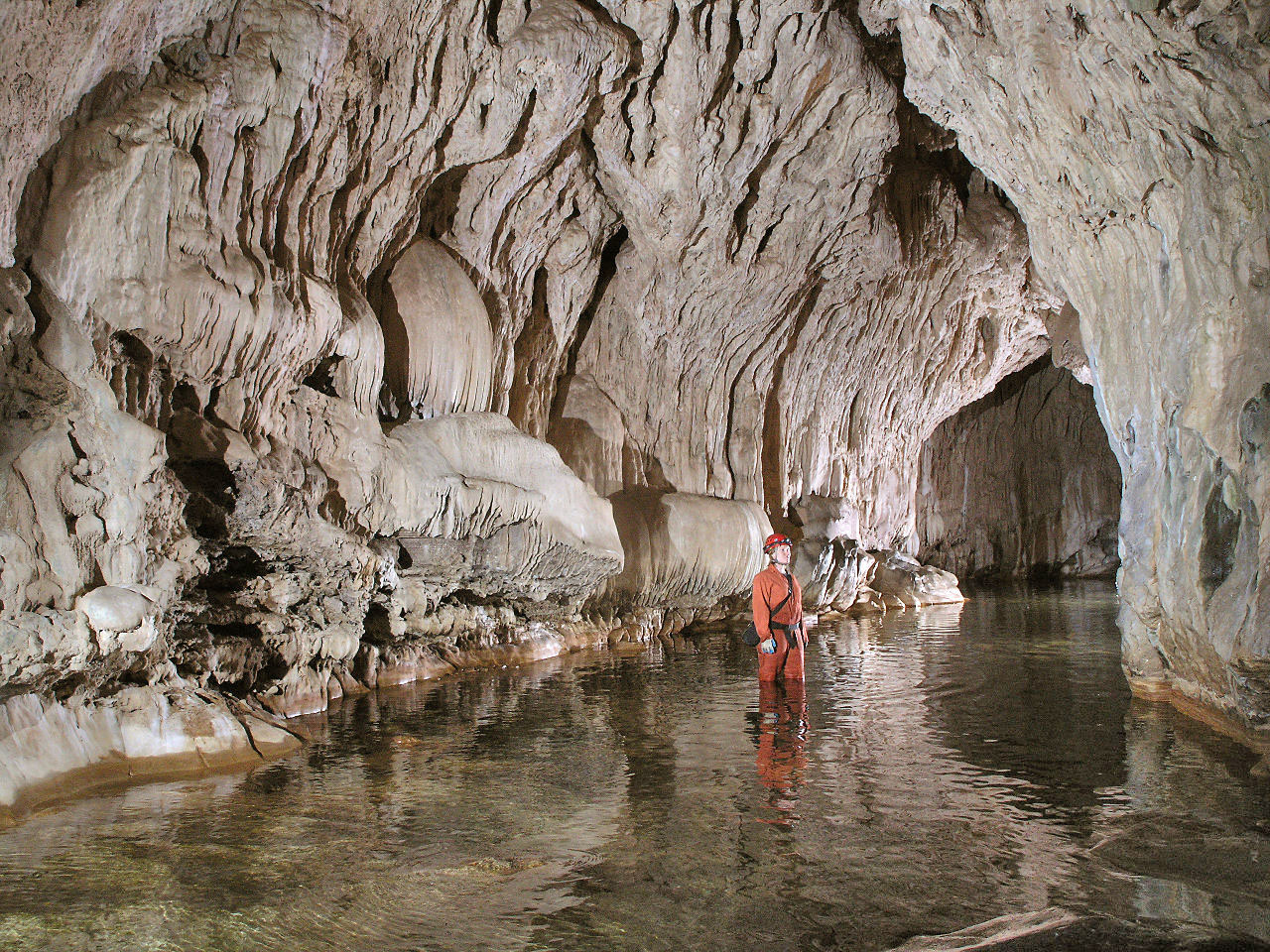 Natural Bridges: There is limited parking available at this trailhead and no drinking water, but there are vault toilets at the parking area. Pets are not permitted on this trail.
Parking for the trailhead is located on Parrotts Ferry Road approximately 3 miles (4.8 km) north of Columbia. This moderate, 0.7 mile (1.1 km) trail leads to Natural Bridges, which is a unique series of caves with Coyote Creek running through them. Natural Bridges is an outstanding but sensitive geologic resource at New Melones Lake. Defacing the resources not only spoils the experience for others, but it is against the law. Please help to protect this unique resource by reporting vandalism and preserving the natural features.
Norwegian Gulch: Parking for the trailhead is located at the New Melones Lake Visitor Center and Museum, 1/4 mile (0.4 km) south of the Stevenot Stanislaus River Bridge on Highway 49. This easy, 1/2 mile (0.8 km) trail offers views of New Melones Lake. The parking lot opens to the public at approximately 8:00 a.m., and includes picnic tables, flush toilets, and drinking water.
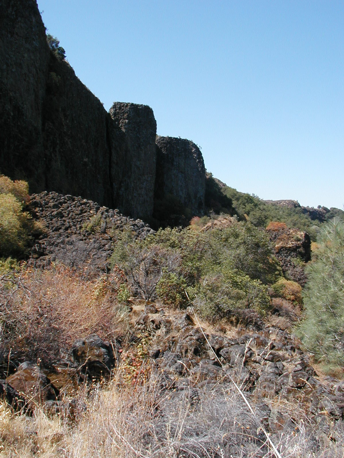 Table Mountain: Shell Road is an unimproved dirt road. It is recommended for high clearance vehicles, and during the winter it may require the use of a four wheel drive vehicle.
Parking for the trailhead is located at the end of Shell Road. At the end of the paved (county-maintained) portion, is a gated road for public access that crosses through private property. Please be respectful of the private property owners while using this road. Vault toilets are located near the trailhead, but there is no drinking water. This is a challenging 1/2 mile (0.8 km) trail up onto a portion of Table Mountain (a 10 million year old inverted lava flow) that involves some rock scrambling across lava rocks. It is recommended to visit this location between April and May as wildflowers will be in bloom.
Peoria Mountain: Medicals often occur on this trail; please be prepared.
Parking for the trailhead is located to the right of the Baseline fire Center along New Peoria Flat Road. This challenging trail is approximately 4 miles (6.4 km) in length, and connects to Peoria Ridge and Green Springs trail. Horseback riding is permitted on this trail. This trail provides beautiful views of New Melones lake.
Peoria Ridge: Medicals often occur on this trail; please be prepared.
Parking for the trailhead is located to the right of the Baseline fire Center along New Peoria Flat Road. This moderate trail is approximately 3.7 miles (5.9 km) in length, and connects to Peoria Mountain, Table Mountain, and Green Springs trail. Horse-back riding is permitted on this trail. This trail provides beautiful views of New Melones lake.
Green Springs: Medicals often occur on this trail; please be prepared.
Parking for the trailhead is located to the right of the Baseline fire Center along New Peoria Flat Road. This moderate trail is approximately 2 miles (3.2 km) in length, and connects to Peoria Ridge, Peoria Mountain, and Table Mountain. Horseback riding is permitted on this trail. This trail provides beautiful views of New Melones lake.
Dutchess Mine: Medicals often occur on this trail; please be prepared.
Parking for the trailhead is located on the Calaveras County side of the Parrots Ferry Bridge. This trail passes through many federal and private properties, please be respectful of the private property owners. This challenging 3.4 mile (5.5 km) trial takes hikers past the remnants of the Duchess Mine and up onto a section of Table Mountain (a 10 million year old inverted lava flow). It is recommended to visit this location between April and May as wildflowers will be in bloom.
Note: Documents in Portable Document Format (PDF) require Adobe Acrobat Reader 5.0 or higher to view, download Adobe Acrobat Reader
