Potholes Supplemental Feed Route Operations
Frenchman Hills Feed Route Inundation Map (East) PDF 4.45 mb
Frenchman Hills Feed Route Inundation Map (West) PDF 4.38 mb
Operation:
Late March-Mid May: 300 cfs up to 700 cfs
Remainder of the year: No Feed
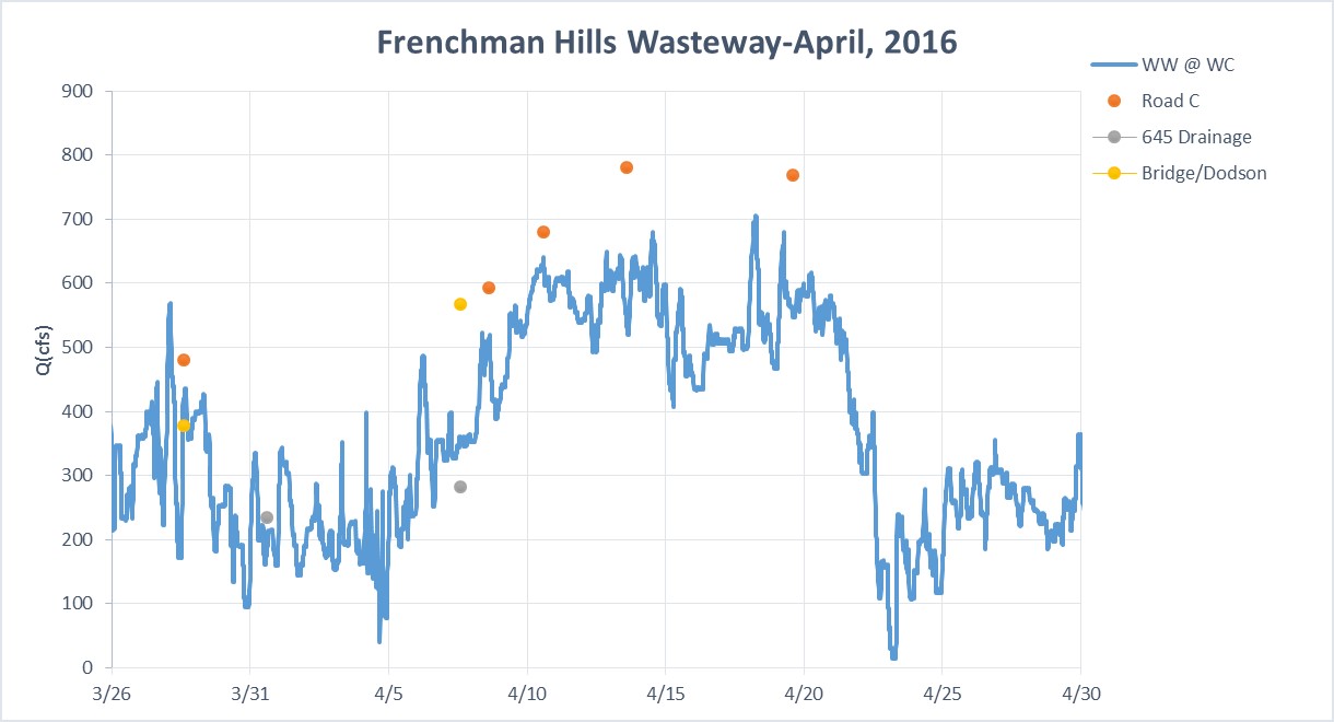
Feed water will also be conveyed from Billy Clapp Reservoir via the Main Canal and West Canal to the Frenchman Hills Wasteway. The West Canal is charged with water from the Main Canal at the bifurcation around the third week of March. The first week of the irrigation season is used to charge the canal systems. The start date for feed through the Frenchman Hills Wasteway is approximately the fourth week of March. As of early April 2016, Frenchman Hills will run at ~300 +/-300 cfs with a maximum of 700 cfs until approximately the second to third week of May. After the month of May, the supplemental feed water will stop. Frenchman Hills Wasteway has the capacity to feed approximately 46,000 acre-feet in the spring to Potholes Reservoir.
Observation Plan:
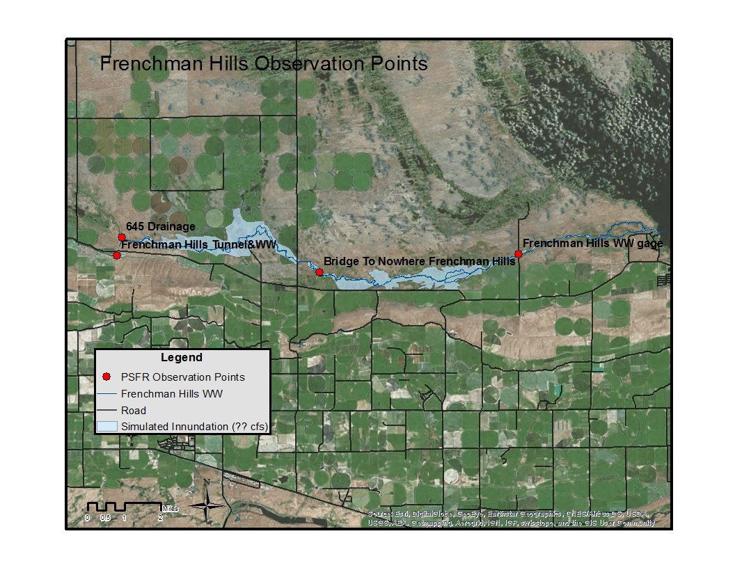
Frenchman Hills Wasteway crosses under two county roads, Dodson Road and Road C SE. The new culverts at the Road C have a capacity of 1,500 cfs and Dodson Road has a capacity of 1,100 cfs. Both crossings will be monitored closely through the months of April and May to observe any changes to the system. In addition to the feed from the West Canal, discharge is routed into Frenchman Hills Wasteway via the 645 drainage. Discharge measurements will be collected at the 645 drainage outlet as well as downstream of Dodson Road and at Road C.
- Outflow at the 645 will be measured at the existing cableway and using the existing staff gage
- Dodson Road elevation will be observed and condition (submerged/depth to full) of each culvert will be recorded
- The “bridge to nowhere” will be used to determine flow through Dodson
- Road C will be measured throughout the water season in order to develop a new rating curve.
Continuing, at least bi-monthly:
- Outflow at the 645 will be measured at the existing cableway and using the existing staff gage. The section was determined “unratable” due to the backwater influence, however, measurements will continue be taken when the feed route is running.
- Dodson Road elevation will be observed and condition (submerged/depth to full) of each culvert will be recorded.
- The “bridge to nowhere” will be used to determine flow through Dodson Rd.
- Road C will be measured throughout the water season in order to develop a new rating curve.
Contact
Jennifer McConnell
Project Manager
jmcconnell@usbr.gov
(509) 754-0237
Bureau of Reclamation
Ephrata Field Office
P.O. Box 815
Ephrata, WA 98823-0815
