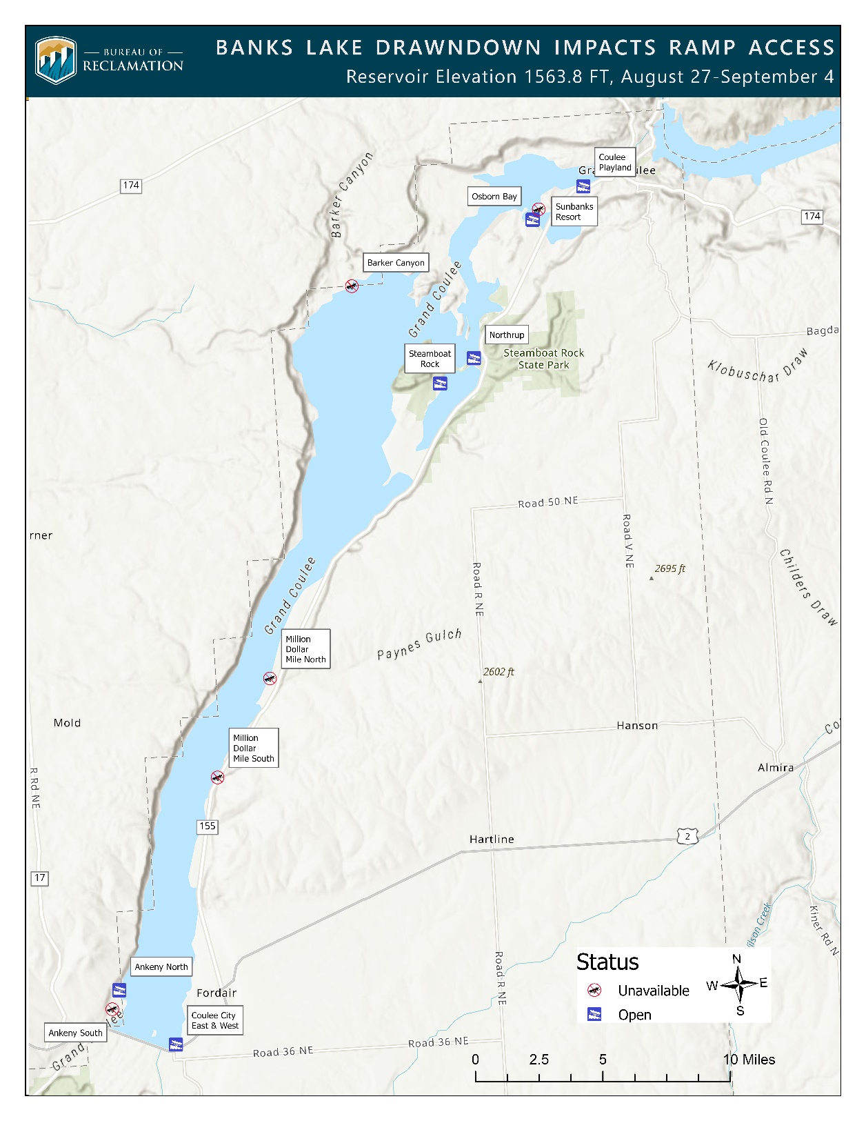
_resize.jpg) Map of ramp access impacted by the Banks Lake drawdown.
Map of ramp access impacted by the Banks Lake drawdown.
Grand Coulee Dam, Wash. – Attention fishing and boating enthusiasts: Several boat ramps at Banks Lake will be temporarily unavailable for a scheduled drawdown.
The Bureau of Reclamation is lowering the elevation of Banks Lake by 6.2 feet to support fisheries and groundwater replacement objectives. The lower-than-normal reservoir levels are expected to start as early as Wednesday, Aug. 27, and may continue through Thursday, Sept. 4. The drawdown will reduce the lake’s elevation to 1563.8 feet, impacting the accessibility of several boat ramps around the lake.
The public is advised to exercise caution around the reservoir and lakeshore during this drawdown period due to shallow water and narrower channels. Areas of high concern, such as the Devil’s Punchbowl, should be approached with particular caution.
This reduction in the lake's elevation occurs annually, from late August through early September. Once fisheries and groundwater replacement objectives are met, the reservoir will be returned to its regular operating elevation. The table below shows which boat ramps will be available during this time. The following map indicates their locations and displays the boat ramps that are temporarily unavailable. The level at which a boat ramp is no longer usable for loading and unloading depends on the size and the type of the watercraft and trailer.
| Ramp Name | Managing Agency | Minimum Usable Ramp Elevation |
| Coulee Playland | Electric City | 1540 (The main launch ties to an additional ramp that can be used down to a water elevation of 1540.) |
| Steamboat Rock - Osborn Bay | Washington State Parks | 1560 |
| Steamboat Rock - Northrup | Washington State Parks | 1560 |
| Steamboat Rock – Main Park | Washington State Parks | 1562 |
| Coulee City Campground - East | Coulee City | 1562 |
| Coulee City Campground - West | Coulee City | 1562 |
| Ankeny North | Washington Department of Fish and Wildlife | 1544 (Limited to small watercraft) |
# # #
