You are viewing ARCHIVED content published online before January 20, 2025. Please note that this content is NOT UPDATED, and links may not work. For current information, visit https://www.usbr.gov
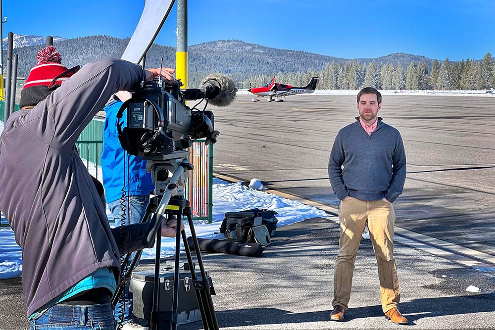 USBR hydrologist, Dr. Scott Fennema, interviewed by DWR at Truckee Tahoe Airport Dec. 10, 2021 (USBR photos by Todd Plain)
CARSON CITY, Nev. — As snow continues to pile up in the Sierra Nevada mountains at the start of 2022, local and federal water managers alike, eagerly anticipate data from snow surveys to find out how much snow is on the ground, the water content of the snow, and exactly where it has fallen.
Estimating snowpack plays an important role in forecasting water supplies. Snow in mountain watersheds, like the Truckee-Carson River Basin, acts as a natural reservoir holding on to the frozen water that will gradually melt and run downhill as the season progresses.
With changes to climate and increasing water demands due to population growth, accurately mapping where the snow has fallen is becoming increasingly important to best determine water allocations for myriad needs and obligations throughout the year.
Arguably, one of the best and easiest ways to map snowfall is from a plane.
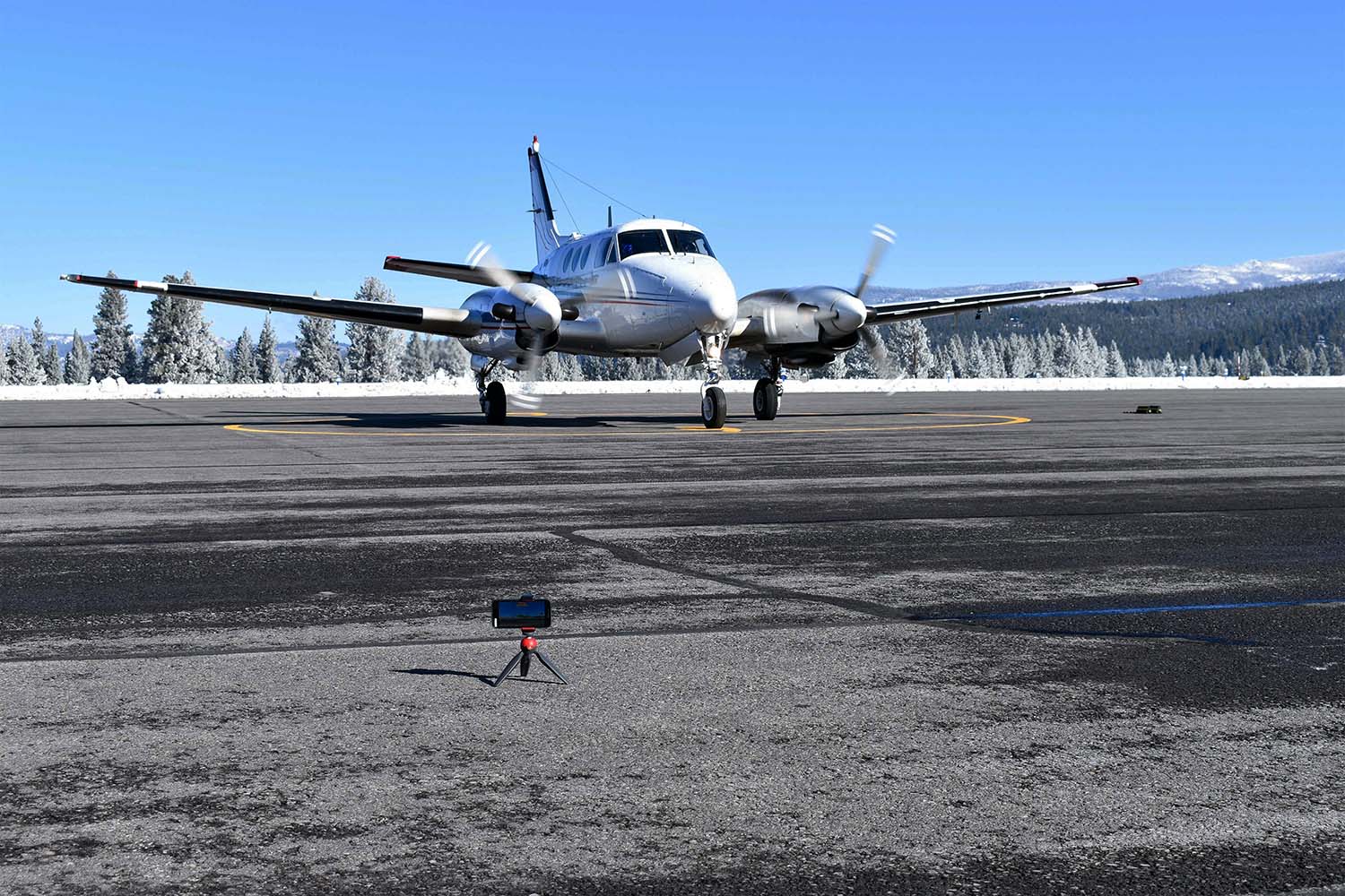
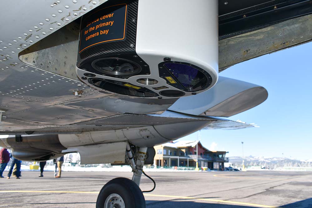
This brings us to the Truckee Tahoe Airport on Dec. 10, 2021, where Bureau of Reclamation and the state of California’s Department of Water Resources teamed up on a new project, to gather high altitude NASA-inspired imagery they hope will accurately detail snow location and depth within the basin.
“Today we’re out here to collect some new snow data that we have never been able to collect before; the plane behind me collects high resolution information about snow depth across the entire watershed rather than single-point estimates like we’ve done in the past,” said Dr. Scott Fennema, a Reclamation hydrologist from nearby Lahontan Basin Area Office in Carson City, Nevada. “This will tell us information about snowpack in areas of the basin we never look at.”
Snow surveys first began in the Truckee-Carson River Basin in 1906, where University of Nevada, Reno's Dr. Church started collecting snow measurements from specific points, and those points are still being used to this day. So, it’s only fitting that the birthplace of snow surveys is also the start of a new aerial snow survey project with Reclamation and DWR leading the way.
The airborne snow data will assist in real world decisions, including improving operations for protecting threatened and endangered fish species; assisting farmers' investments into which crops to plant in dry versus wet years; improving flood management decisions; and optimizing hydropower generation.
“This project is a complete and total partnership between us at the Bureau of Reclamation and the California Department of Water Resources,” added Fennema. “We’re partnering from the start to the end of going through and collecting this data and taking that data and trying to turn it into a river forecast for the Truckee and Carson rivers. It’s a great partnership and we’re hoping it will grow into the future so we can use this information to better inform river operations.”
--
Special thanks to the other snow survey partners: Natural Resources Conservation Service, US Geological Survey, NASA, National Oceanic and Atmospheric Administration, and US Army Corps of Engineers.
