

Santa Ana Watershed Basin Study
In 2010, the Bureau of Reclamation collaborated with the Santa Ana Watershed Project Authority (SAWPA) to develop a Basin Study proposal for conducting a comprehensive water resources assessment of the Santa Ana Watershed, and update SAWPA’s "One Water One Watershed" Plan.
SAWPA, a joint powers authority that represents five major water resources agencies (Eastern Municipal Water District, Inland Empire Utilities Agency, Orange County Water District, San Bernardino Valley Municipal Water District, and Western Municipal Water District) joins over 350 water, wastewater and groundwater management, flood control, environmental and other nongovernmental organizations in a collaborative integrated water resources management plan called the “One Water One Watershed” (OWOW) Plan.
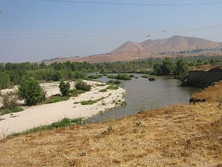
The Santa Ana River Watershed is Southern California’s largest watershed, and is home to more than 6 million people. Covering nearly 3,000 square miles of mountains, foothills and valleys, this watershed area contains 50 tributaries and portions of Los Angeles, Riverside, San Bernardino and Orange counties. The flow of the Santa Ana River begins in the San Bernardino Mountains and discharges into the ocean at Huntington Beach.
This Basin Study will update the OWOW Plan by characterizing current and future water supply and demand imbalances in the watershed and assessing the risks to its water resources including water allocations and deliveries, recreation, fish and wildlife and their habitats, water quality, and flood control. Through this Study, the SAWPA will:
-
 Develop water demand reduction strategies through education and outreach
- Create processes for water quality improvement.
- Conduct expanded outreach to disadvantaged communities and Native American Tribes to support clean, safe, reliable water supplies.
- Identify opportunities to restore natural systems and hydrology.
- Expand collaboration to create strong relationships throughout the region.
- Conduct a detailed and system-wide evaluation of the impacts of climate change to water infrastructure operations and determine new adaptation tools that can assist water managers in responding to these changes.
- Develop system-wide approaches and leadership for new watershed-wide resource management actions.
The Study’s approach incorporates past and present regional and local planning studies within the Santa Ana Watershed; an innovative “bottom up” collaborative approach to regional water resources management; use of advanced science, technology, and modeling to assess climate change and greenhouse emissions, in addition to adaptation planning on a watershed basis; and significantly expanded outreach to all major water users and stakeholders in the watershed.
Work began on the 50/50 cost-share Study ($2.528 million total cost) in May 2011, and it is expected to be complete by the fall of 2013. With stakeholder participation and input, the technical Study will incorporate information from the latest science, engineering, technology, climate models, and innovations. Its analysis of strategies and options will be similar to an appraisal-level studyto assist in justifying and preparing feasibility studies, environmental compliance activities, demonstration programs, and/or implementation.
| Study Timeline |
|
May 2011 |
Begin Study |
May 2011-February 2012 |
Characterize water supply & demand |
May 2011-September 2012 |
Identify legal & regulatory constraints |
July 2011-January 2013 |
Research climate change mitigation/adaptation |
January 2013-March 2013 |
Identify options & strategies |
September 2013 |
Publish draft plan report |
October 2013 |
Publish final plan report |
Send questions or comments via :
e-mail: OWOWBasinStudy@usbr.gov
phone: (951) 695-5310 / TTY: 711
fax: (951) 695-5319
Updated: October 2013