Biologists complete 13th season of summer bird banding along lower Colorado River
"It’s great to see all of the birds that show up to a restoration site, within just a few years after planting." Those words reflect just a small portion of the sense of satisfaction Wildlife Biologist Chris Dodge experienced at the conclusion of this summer's bird banding along the lower Colorado River. Sharing in Dodge’s experience were Wildlife Group staff members Biological Science Technician Joe Kahl, Environmental Assistant Jenny Smith, General Biologist Mary Ellen Given, General Biologist Nathan Lenon, and Acting Wildlife Group Manager/General Biologist Andi Finnegan. This year is the thirteenth consecutive year the Bureau of Reclamation has carried out this activity, formally known as the Monitoring Avian Productivity and Survivorship Program or MAPS, along the lower Colorado River. It is a cooperative effort among various agencies, non-profits, and other bird researchers throughout the continental United States, Canada, and Mexico, to provide long-term population and demographic data for more than 100 targeted species of birds, at multiple spatial scales, according to the 2012 MAPS protocol by the Institute for Bird Populations. The protocol additionally states the program consists of a continent-wide network of constant- effort mist-netting stations to capture birds, record demographic information, and fit them with a coded leg band for future recaptures. Then, the data are forwarded to the Institute for Bird Populations, which analyzes continent-wide bird population trends. Currently, three stations are in operation Cibola National Wildlife Refuge, Havasu National Wildlife Refuge, and the Cibola Valley Conservation Area, which was added in 2011. The monitoring began before the Lower Colorado River Multi Species Conservation Program (LCR MSCP) was introduced, and was incorporated into the LCR MSCP to provide information about bird use of restoration sites, especially those birds that are included in the program. 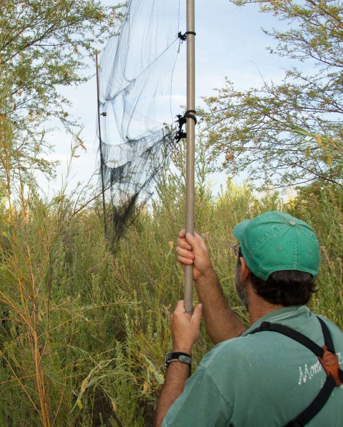
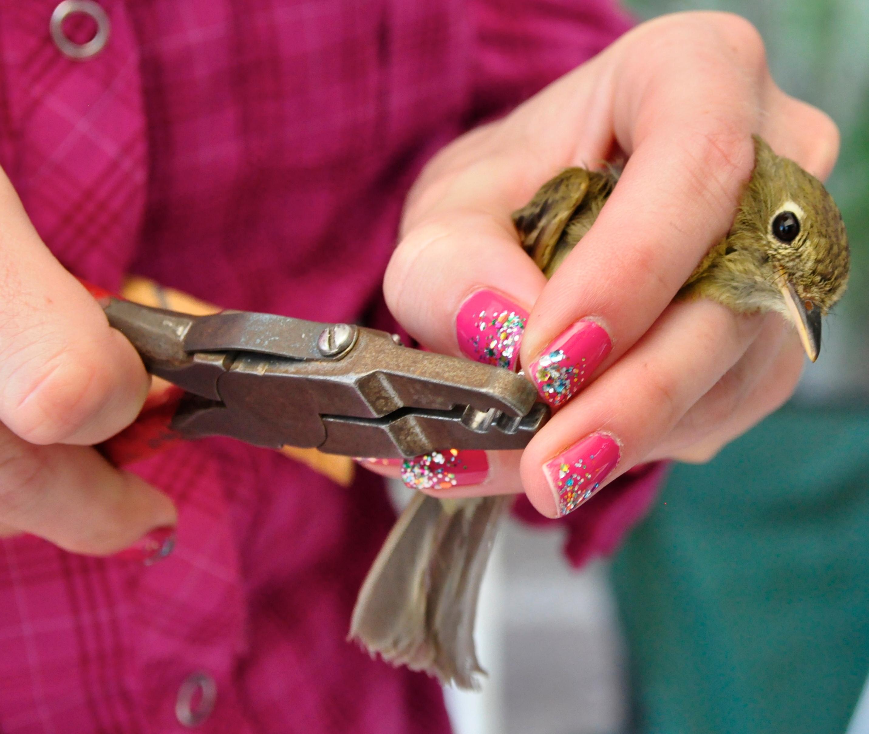
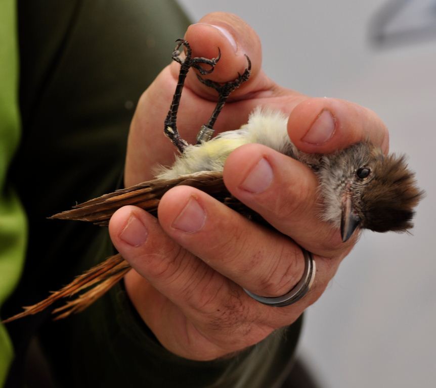
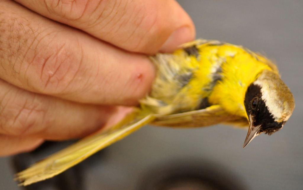
Some of what the MAPS program can tell researchers includes what species of birds are using a specific site, what their population structure looks like locally, and what kind of population trends are occurring with the targeted species on a larger, continental scale. "At our sites, we set up the nets one-half hour before sunrise, using headlamps to navigate through the vegetation, sometimes very dense stands of cottonwood, willows, and mesquite," said Lenon. "The nets are typically opened at local sunrise, but may be opened earlier in very hot climates. Then, the nets are closed five hours after sunrise normally, but with the high temperatures we typically experience in the summer, it is often necessary to close the nets by 9 a.m. to minimize stress on the birds." The program uses a standardized protocol, which defines the methodology, provides data sheets, and establishes codes for recording observations. Captured birds undergo a variety of measurements to determine age, sex, and reproductive status, before receiving a coded leg band. Through statistical analyses of recaptured-banded birds, LCR MSCP biologists can develop a better understanding of how restoration activities are affecting sensitive species. "We have captured the same bird at multiple sites within a single season," said Dodge. "For example, yellow warblers moved from the Cibola Nature Trail to Cibola Valley Conservation Area on two separate occasions. These are both LCR MSCP restoration sites." MAPS monitoring takes place each summer from early May to early August and, according to the biologists, it is scheduled to continue into the future. For more information about the MAPS activities in support of the LCR MSCP, visit http://1.usa.gov/1dkK9o0.
|

Search Reclamation