Arthur V Watkins Dam

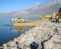
On November 13, 2006, piping erosion was observed below the dam by a local landowner. After emergency response personnel arrived, it was also found that excessive seepage, sand boils, and erosion were occurring at the toe of the dam. Emergency action was implemented, which initially resulted in placing gravel over the sand boils at the downstream toe until the flow velocities were reduced and then placing filter sand over the gravel. A large berm of pit-run soil was then placed over the filter and gravel. A second berm was then placed at the upstream toe of the dam to plug upstream entrance locations of the seepage. At the same time, an emergency drawdown of the reservoir was begun.
The interim repair consisted of the construction of an infilled, upstream ring dike approximately 650 feet wide to isolate the damaged section of the dam; a new 700-foot-long filtered toe drain with three inspection wells and sediment traps; and a restriction of the reservoir elevation.
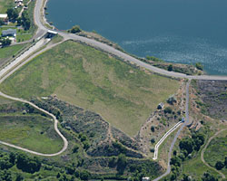
A fully penetrating cement-bentonite cutoff wall through the embankment was constructed to arrest the static piping and internal erosion deficiencies of the dam. The 30-inch wide C-B wall was constructed during the summer and fall of 2008. It was constructed from the crest, through the embankment, and a minimum of five feet into the clay deposits that underlie the sandy materials, thus mitigating the potential for piping through the embankment. The length of the wall was approximately 28,000 LF between dam stations 468+00 and 733+00.
Deer Creek DamDue principally to seismic concerns, Deer Creek Dam underwent a phased modification, with dam safety construction efforts driven by Reclamation in the midst of road construction work undertaken by the Utah Department of Transportation. Reclamation's Phase I work, performed in 2003-2004, consisted of excavating and backfilling a shear key located in the foundation alluvium at the downstream toe of the embankment in order to limit slope movement and embankment deformations in the event of liquefaction of foundation soils. Much of the alluvium between the downstream toe of the dam and the spillway was removed and replaced with stronger and denser earthfill. In addition, a two-stage filter and drain age system were placed on the excavated surfaces. As the UDOT berm was being constructed on the downstream slope of the existing embankment, the sand filter was continued up the existing dam slope, for the full height of the berm.
In conjunction with the Reclamation modifications, UDOT relocated U.S. Highway 189 by constructing a bridge that spans the spillway chute and channel and tie into the existing highway along the left reservoir rim. In addition to miscellaneous road alignments to accommodate this change and the large bridge, a massive earthfill berm was placed against the downstream face of Deer Creek Dam at UDOT’s expense.
Phase II of Reclamation's modification happened during 2007 and consisted of a reinforced concrete overlay on the spillway chute. A one-foot-thick slab of concrete was placed over the chute floor, bonded and anchored into the existing 9-inch-thick concrete slabs, including waterstopped joints.
Finally, during 2007-2008, Phase III involved stabilizing the spillway gate structure against earthquake shaking and providing additional seismic protection for the dam embankment. The modification consisted of installing struts between the spillway walls and additional concrete reinforcement blocks on the outside of the walls. Also, another portion of Phase III involved raising the dam crest an additional 5 feet to provide additional protection against dynamic deformations and cracking.
Echo DamA contract was awarded in August 2011 for foundation and embankment seismic improvement work at Echo Dam, Summit County, UT. Field investigations at Echo Dam indicated that the foundation soils underlying both the dam and spillway were potentially liquefiable during a substantial earthquake, which could cause the dam and spillway to deform. Beginning in October 2011, a large excavation on the downstream side of the dam to remove loose and liquefiable foundation soils began with dense compacted materials refilling the excavation. Additional work includes construction of a large stability berm on the downstream side of the dam; raising the dam’s crest by three feet; and construction of a second stability berm on the upstream side of the dam.
Fontenelle DamExplorations performed in the early 1980's indicated the presence of soft zones in the dam embankment on the left side. About this time, seepage was observed for the first time near the toe of the dam indicating the possibility of piping deficiencies existing at the dam. A continuous concrete cutoff diaphragm wall was constructed along the dam axis across the full length of the dam and into the abutments to prevent seepage.
Two phases of cutoff wall construction were performed between 1985 - 1989. First, a test section was constructed to evaluate the effectiveness and ability to construct a concrete cutoff wall through the embankment and foundation materials. Second, the cutoff wall was constructed in those areas not completed by the test section. The wall penetrated the upper 20 feet of bedrock and additional grouting was performed from inside the outlet works conduit to intercept seepage paths underneath the conduit immediately downstream of the gate chamber.
Hyrum Dam
In the fall of 1990, a Rehabilitation and Betterment Program was begun to address a number of features at the dam that had deteriorated over time. The outlet works intake structure was rehabilitated by removing sediment from inside the intake structure, and installing a prefabricated vertical extension on the existing intake structure trashrack. The outlet works conduits were re-painted, both interior and exterior, and a new hydraulic control system for the outlet works gate controls was installed. Other pertinent mechanical equipment was also rebuilt. The spillway was rehabilitated by sealing cracks and joints in the spillway chute and replacing or repairing the concrete as needed. The radial gates, hoists, and electrical control system were also refurbished. The hillside below the outlet works control house was stabilized by installing a block-faced reinforced earth retaining wall and the access road to the outlet works control house was re-graded.
Between July 2004 and March 2005, emergency modifications were performed to repair the lower portion of the spillway discharge chute that had significantly deteriorated. These modifications consisted of saw-cutting the spillway discharge chute floor and about two feet of the lower portion of the chute walls, removing and replacing the saw cut concrete down to the stilling basin, drilling and anchoring the existing chute walls, filling and compacting voids beneath the chute floor while installing cutoff walls, filters, gravel and pipe underdrains, and replacing the cut concrete walls and chute floor.
Lost Creek DamLost Creek Dam was identified as having a liquefiable foundation incapable of maintaining stable slopes during a large seismic event. Dynamic compaction was used near the upstream and downstream toes of the earthen structure to densify and strengthen the foundation materials. The work completed between 1997 -1999 required the draining of the reservoir, the construction of a river bypass pipeline with 60-inch HDPE pipe and the removal of all reservoir sediment immediately upstream of the dam. A downstream stability berm was constructed following dynamic compaction.
Meeks Cabin DamA dam safety modification was constructed in 1994-1995 to address foundation seepage concerns. The modification consisted of a plastic concrete cutoff constructed from just below the dam crest to an elevation below the glacial outwash gravel through the left side of the dam. The plastic concrete cutoff wall is 36-inchs wide, 825-feet long, on the left abutment, 14 feet upstream of the dam centerline. The cutoff wall penetrates the embankment and the upper foundation materials to depths ranging from about 130 to 170 feet.
Newton DamNewton Dam was modified because of safety concerns that the dam would be unable to contain the Probable Maximum Flood. The modification consisted of a 2.75-foot crest raise, removal of the auxiliary outlet works, rehabilitation of the service and emergency spillways, and the construction of a training dike downstream from the emergency spillway. This work occurred between 1987 – 1988.
Pineview DamIn 1992, a stability berm was added on the downstream side of the dam. The berm was 40 feet high and extended out from the face of the dam about 400 feet. The berm was constructed to improve stability of the dam and foundation against seismic events that may cause liquefaction in the foundation. A 13-foot-diameter multi-plate corrugated metal pipe culvert was constructed within the downstream stability berm to accommodate side channel flows from Wheeler Creek.
From May 2002 to June 2003 the spillway control structure and upper portions of the spillway were modified to address seismic deficiencies. The structural modifications to the spillway included installing steel plates along the left spillway structure using anchor bars to secure the left side of the spillway, replacing loose material between the right spillway wall with backfill concrete, installing rock bolts along the right wall of the spillway structure to secure the right side of the spillway, installing steel struts and load distribution beams between the three spillway walls to create a frame out of the crest structure so it can withstand the design maximum credible earthquake load. The spillway concrete walls were also extended upstream to accommodate a new spillway gate control house.
The radial gates were removed and refurbished and the radial gate wall plates were replaced. A face plate support system that consisted of 4-inch diameter stainless steel posts (gate catcher) extending from the lls and pier on each side of the gates was installed to catch the gate in the event of a support arm failure.
In the 2005 modifications of the dam, liquefiable foundation materials were removed via a deep foundation excavation near the downstream end of the stability berm constructed during the 1992 modification and backfilled with a select backfill material and the stability berm was also raised by 10 feet. The central section of the dam crest was raised by 10 feet using a vertical, reinforced concrete retaining wall along the downstream edge of the dam crest. The crest raise consisted of several zones of material including a 6-foot wide impermeable core that was tied into the existing core material as well as a filter-drain and transition material zones.
The crest raise provides added embankment fill to compensate for possible settlement during a seismic event and provides filter protection in the event of a seismic cracking of the embankment. As part of the construction for the raised berm, the 13-foot-diameter Wheeler Creek CMP was extended to accommodate the berm raise and a river and creek diversion system on Wheeler Creek was added to divert flows from Wheeler Creek into the Ogden City Water Treatment Plant.
Scofield Dam
In 1996, Scofield Dam was renovated to address seismic liquefaction concerns for the foundation and to bring the dam up to current standards for filter compatibility and seepage collection. The safety of dams renovation consisted of installing vibro-replacement stone columns in the alluvium downstream of the dam, constructing a downstream stability berm, and placing a new filter and seepage collection system consisting of a chimney filter, horizontal drainage blanket and drain collection system. The renovation required removal of the small waste pile berm on the downstream toe, removal of the original toe drains, and temporary removal of all the rockfill from the downstream slope of the dam.
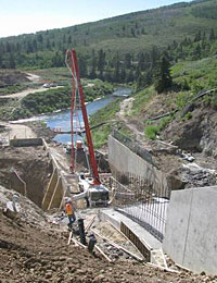
In September of 2007, renovations began to replace the highway bridge over the spillway, the gate house on top of the dam, the spillway above the spillway basin, and installation of filter materials beneath the spillway and on portions of the downstream face to collect seepage. These renovations were needed to address dam-safety concerns with the spillway and bridge, including significant deterioration of the spillway and bridge concrete, and potential slab jacking of the spillway joints during a flood event.
In September of 2007, renovations began to replace the highway bridge over the spillway, the gate house on top of the dam, the spillway above the spillway basin, and installation of filter materials beneath the spillway and on portions of the downstream face to collect seepage. These renovations were needed to address dam-safety concerns with the spillway and bridge, including significant deterioration of the spillway and bridge concrete, and potential slab jacking of the spillway joints during a flood event.
Steinaker DamFrom March 1993 to November 1994, Steinaker dam was modified in order to mitigate seismic concerns with regards to the stability of the foundation soils under the dam. Dynamic compaction was used to densify the foundation soils and then a berm was constructed downstream of the toe of the dam. The treated area was approximately 150 feet wide and 550 feet long. The work involved the removal of the upper 15 feet of soils prior to performing dynamic compaction on the lower 15 feet of soils. Dynamic compaction was performed by dropping a 30-ton weight from 112 feet. It was also necessary to dewater the area prior to construction as well as relocate Rock Point Canal and replace the toe drain of the dam.

