- Reclamation
- Pacific Northwest Region
- Programs & Activities
- Yakima River Basin, Water Storage, Feasibility Study
- Interstate 82 Bridge Over Lmuma Creek, May 2007
Yakima River Basin Water Storage Feasibility Study
Interstate 82 Bridge Over Lmuma Creek, May 2007
Home | Reports/Documents | News Releases | Photos | Email List | Contact Us
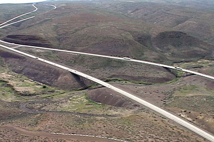
May 2007: Arial photo of east and westbound bridges over Lumuma Creek looking northeast. The upper end of the proposed Wymer Reservoir will extend upstream of the bridges a few miles at normal water surface elevation of 1730 feet.
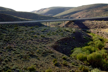
May 2007: Westbound Interstate 82 bridge at Lmuma Creek looking west. This is at the upper end of the proposed Wymer Reservoir. The normal water surface will be approximately 30 feet below the bottom of the bridge.
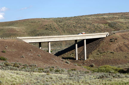
May 2007: Eastbound I-82 bridge at Lmuma Creek looking southeast. This is near the upper end of the proposed Wymer Reservoir. The water surface would be approximately 12 feet below the bottom of the bridge.
