- Reclamation
- Columbia-Pacific Northwest Region
- Hydromet
- General Information
Bureau of Reclamation, Pacific Northwest Region
Tualatin River Basin Storage and Flow Diagram
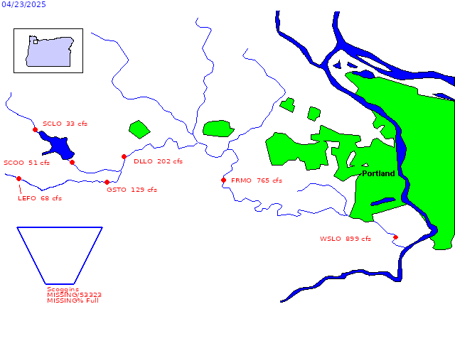
Data from stations DLLO and WSLO provided by US Army Corps of Engineers.
Data from station LEFO provided by Oregon Water Resources Dept.
Average daily streamflows indicated in cubic feet per second.
Reservoir levels current as of midnight on date indicated.
Click on image elements for current-data or multi-year hydrographs.
DLLO  ==  Tualatin River near Dilley (US Army Corps of Engineers)
GSTO  ==  Tualatin River at Gaston
LEFO  ==  Tualatin River below Lees Ferry (OWRD)
SCLO  ==  Scoggins Creek above Henry Hagg Lake
SCO   ==  Scoggins Dam and Henry Hagg Lake
SCOO  ==  Scoggins Creek below Henry Hagg Lake
WSLO  ==  Tualatin River near West Linn (US Army Corps of Engineers)
Tualatin Project Information
