- Reclamation
- Columbia-Pacific Northwest Region
- Environmental Documents
- New York Canal
- About the New York Canal
About the New York Canal
.jpg)
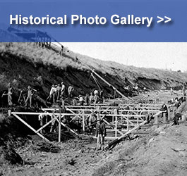
The New York Canal is 41 miles long, conveying water from the Boise River westward toward Lake Lowell. The Canal provides irrigation water to about 165,000 acres in the Boise Valley. Construction of the canal began in the late 1800s and it was enlarged between 1909 and 1912 by the Bureau of Reclamation. In 1926, Reclamation transferred operation, care and maintenance of the Canal to the Boise Project Board of Control. The canal's current operating capacity is approximately 2,450 cubic feet per second.
Related Links
Project Data
Boise Project Map PDF 1.92 mb
Partners
Boise Project Map
Boise Project Brochure PDF 2.06 mb
Idaho State Historical Society: The Beginning of the New York Canal
History of the Boise Project Board of Control
Water in the Boise Valley: A History of the Nampa & Meridian Irrigation District
New York Lining Project
Contacts
Bureau of Reclamation
Columbia-Pacific Northwest Regional Office
1150 North Curtis Road, Suite 100
Boise, ID 83706-1234
Public Affairs Office
pninfo@usbr.gov
Boise Project Board of Control
2465 Overland Road
Boise, ID 83705-3255
(208) 344-1141
