

Keswick Dam Closure Area Aerial Photograph
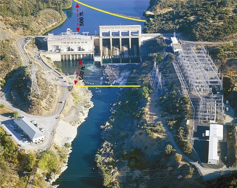
The photograph is an aerial view that depicts the Keswick footprint of land, and facilities covered by this closure order. There are yellow markings both upstream and downstream of the dam that show the closure boundaries.